I am not a Pacific Northwest or Washington native, but I moved here for the mountains and have done a fair bit of exploring with well over 100 hikes ranging form easy to a couple of Washington’s volcanoes. This is a map of most of the hikes I have done. The ones with blue icons have articles or videos that you can find by clicking on them.
Out of all these I loved most of them, but some stand out as particularly special. Instead of picking the best of the best, I tried to pick the best for a variety of categories so you can pick based on your interests and/or the season.
Best Hikes for…
- Summer - Chain Lakes, Yellow Aster Butte, Skyline Divide
- Fall - Park Butte, High Pass, Cutthroat Pass
- Winter - Franklin Falls, Big Four Ice Caves, Kendall Peak Lakes
- Spring - Heather Lake, Chelan Lakeshore, 4th of July
- Alpine Lakes - Watson Lakes, Summit Lake, Blanca Lake
- Mountain Peaks - Yellow Aster Butte, Mount Teneriffe, Trappers Peak
- Accessible - Big Four, Washington Pass, Rainy Lake
- Easy - Washington Pass, Twin Falls, Heather Lake
- Short (Under 5 miles) - Snoquera Falls, Winchester Mountain, Poo Poo Point
- Challenging but Worth it - Mount St Helens, Camp Muir, Enchantment Through Hike
- Waterfalls - Twin Falls, Snoquera Falls, Marshall Falls
- Backpacking - Twin Lakes, Park Butte/Railroad Grade, Chelan Lakeshore
- Hidden Gems - Eightmile Lake, High Pass, Greider Lakes
Remember to pack you basics & park passes. For park pass options check out Washington Trail Association’s article: Recreation Passes and Permits. Enjoy!
3 Best Summer Hikes - In Order of Difficulty
Tip: I like to leave a clean shirt and some ice water in the car in a thermos for after the hike.
Chain Lakes - Moderate
Mountains, lakes, glaciers, volcanos, and a touch of wildlife! This one is popular but there is usually plenty of parking in the lower lots. Check conditions, because this place gets a ton of snow and it can take a surprisingly long time to melt. Late in the season there are lots of ripe berries.
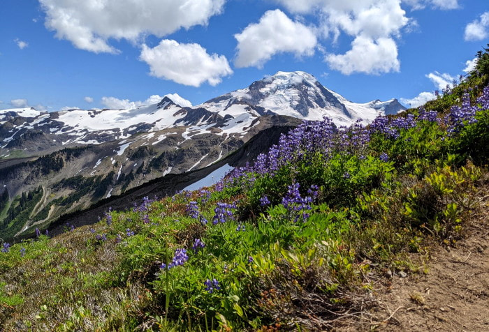
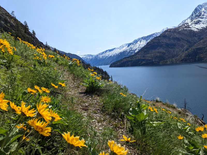
Yellow Aster Butte - Moderate
This area gets lots of wild flowers and the surrounding mountains are almost just as colorful as the flowers. On a clear day you also get a beautiful view of Mount Baker. There are several trail options and this area is popular for backpacking. Check conditions on WTA. Check the wildflower map if you want to see the bloom.
Skyline Divide (Mount Baker) - Moderate
Want to climb a little slice of Mount Baker? Skyline Divide is a ridge that extends out from the volcano with a series of humps. In the summer they are covered with flowers and you can see mountain peaks in every direction. See my trip report for more details and tips. The road may be closed so check conditions on WTA. Check the wildflower map if you want to see the bloom.
3 Best Fall Hikes - In Order of Difficulty
Park Butte & Railroad Grade - Moderate
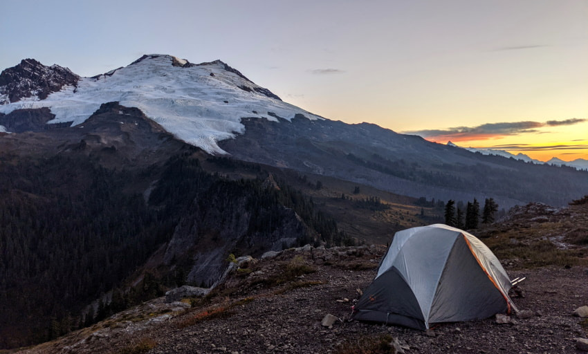
I make a trip here every year! You can do this as a day hike, backpack to the foot of the glacier on Railroad Grade, or try your luck at staying in the Park Butte Fire Lookout. This area is always beautiful, but in the fall the exposed blue glaciers contrasting against the fall colors is really worth a trip! Click here for our how to and options for this area. Check conditions on WTA for Park Butte and Railroad Grade.
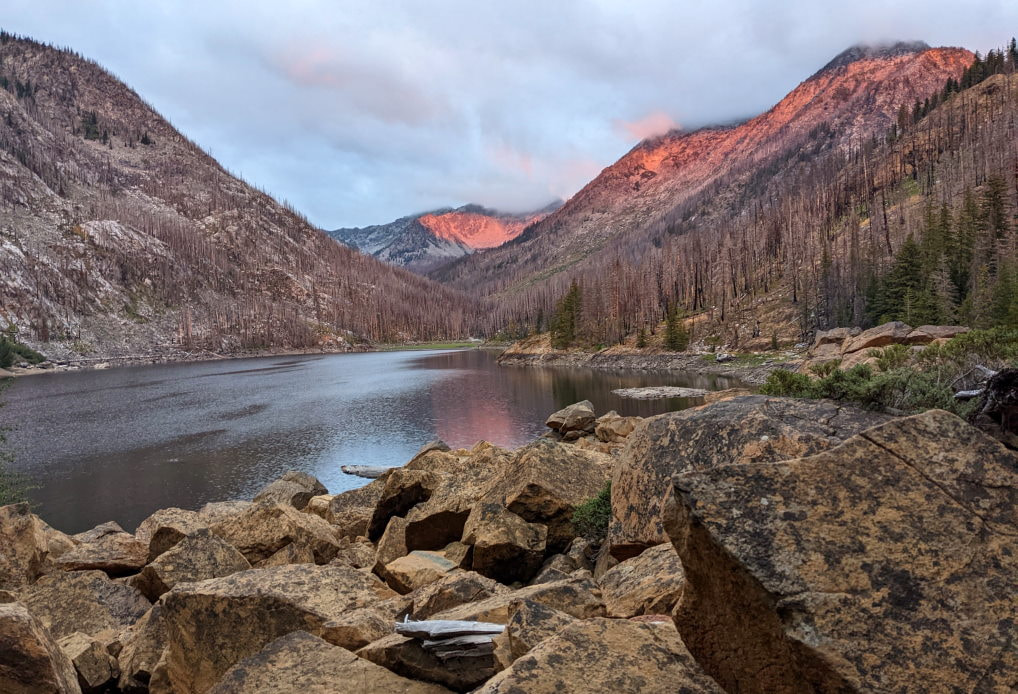
High Pass & Winchester Mountain - Moderate
When we visited in September the colors were vibrant, there were plentiful berries, and a few wildflowers were still hanging on. This area far surpassed my expectations, but it is not the easiest to get to. I have details and videos here.
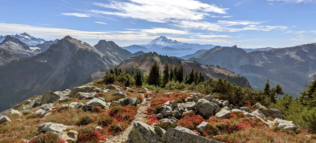
Cutthroat Pass - Moderate
For fall larch madness this is my pick! You can usually join the larch march here without getting trampled by the crowds. You probably won’t be alone on the PCT side, but on the lake side there is a good chance of finding solitude. Check conditions on WTA for the West Side PCT Trail and the East Side Lake Trail.
3 Best Winter Hikes - In Order of Difficulty
Tip: A hot drink or warm meal on a winter hike is always a nice treat.
Franklin Falls - Easy to Moderate
Frozen waterfalls, beautiful mountains, human size icicles, and a winter wonderland forest walk, with a highway cutting through it all made for a great quirky adventure. You can extend this hike along Denny Creek to make it as long as you want. This area does get very crowded and it is an avalanche zone, so plan accordingly. Check conditions on WTA.
Big Four Ice Caves - Moderate
This is an awesome destination year round, but in the winter they close the road a couple mile short of the regular trailhead and the road turns into a showshoe and ski track. Often this section is packed down enough for boots, but once you get to the trail conditions may change. The basin is a stunning cathedral of icy rock with ice caves forming at the bottom from the frequent avalanches. Check conditions on WTA and NWAC.
Kendall Peak Lakes - Moderate
This is a lake trail, but much of the winter the lakes are frozen over, so you true destination is the trail itself and the viewpoint just past the lakes. On a clear day you can see Mount Rainier. You will need a Sno Park Pass for parking in the winter. Check conditions on WTA.
3 Best Spring Hikes - In Order of Difficulty
Heather Lake - Easy to Moderate
This is a beautiful lake with a boardwalk, allowing you to explore it and get the views from all sides. If you drive up this is a short easy hike, but the road up there has some pretty big potholes, so I usually park below and walk up. Check conditions on WTA.
Chelan Lakeshore - Moderate to Hard
Lake Chelan is a narrow strip of icy blue water surrounded by snow-cover peaks and it reminded me of a fjord. Trailhead access is by boat only, and a reservation is needed, so a little planning is required. Our article includes a video and details a number of options for exploring this area.
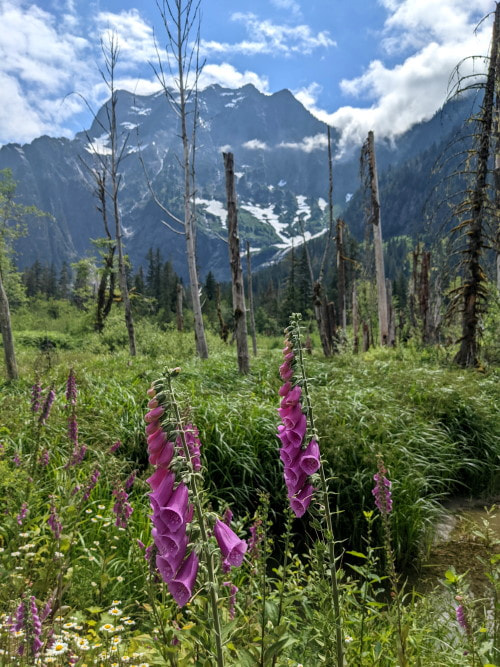
Fourth of July to Icicle Ridge - Hard
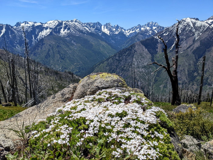
This area takes a little longer to thaw out, but when it does the flowers are prolific. On a clear day you can see countless snow capped mountains, including Glacier Peak. Check conditions on WTA. Check the wildflower map if you want to see the bloom.
3 Best Alpine Lakes - In Order of Difficulty
Watson Lakes - Easy to Moderate
Something about the mountains and the reflections here make these lakes really special. The trails to Anderson Lakes are an easy walk complete with some boardwalks and a little up and down, the first Watson Lake requires a little elevation change going over a ridge, and the far side of the second Watson Lake is barely a trail, but worth it. Check out our Watson Lakes full article for details. Check conditions on WTA.
Summit Lake - Easy to Moderate
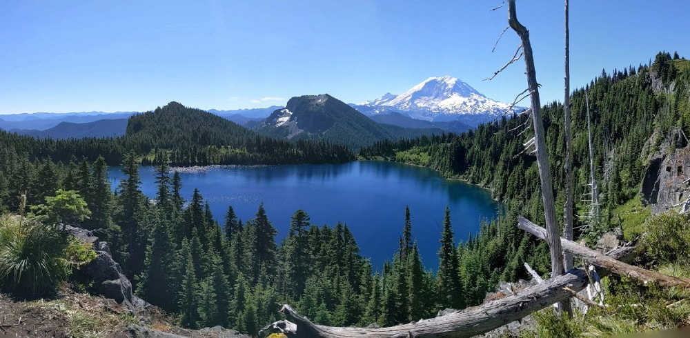
Crystal clear water, stunning views of Mount Rainier, plentiful wildflowers, mountain summit with panoramic views, and a peaceful forest trail! This hike has it all, just make sure you are prepared for what it take to get there! Our article includes a video of the road and tips for the hike. Check conditions on WTA. Check the wildflower map if you want to see the bloom.
Blanca Lake - Moderate
This is one of those shady trails that is perfect to shield you from the sun on a summer day, or even the rain. The mountain ringed lake at the end with its unique coloring is well worth the trek to see it. Our article has more info on the journey and photos. Check conditions on WTA.
3 Best Mountain Peaks - In Order of Difficulty
Yellow Aster Butte - Moderate
This area gets lots of wild flowers and the surrounding mountains are almost just as colorful as the flowers. On a clear day you also get a beautiful view of Mount Baker. There are several trail options and this area is popular for backpacking. Check conditions on WTA. Check the wildflower map if you want to see the bloom.
Mount Teneriffe - Hard
This hike is mostly tree covered, with just small glimpses here and there, so when you pop out of the trees at the top that view takes your breath away. On a clear day you can see Seattle and all the way to the Olympics. There are several possible routes, with Kamikaze being the more challenging by far and in my opinion the most fun. Our article has more details and photos. Check conditions on WTA.
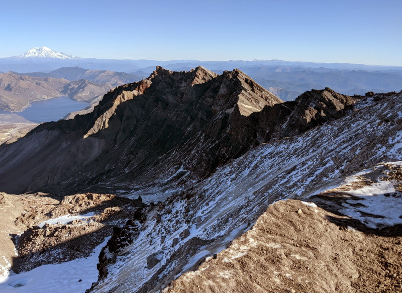
Trappers Peak - Hard
This peak comes with stunning lake, mountain, and glacier views, but it requires a little scrambling to get there. The approach is a long bumpy uphill trek with not a ton to see, but if you are up for it and the conditions are right this one is really incredible. See more details on my trip report. Check conditions on WTA.
3 Best Accessible - In Order of Difficulty
Big Four - Accessible with a View from the Road
At the Big Four Picnic Area you have the option of just gazing at it from your car, getting out and enjoying the view and a history lesson from the picnic area, or meander down the boardwalk and path. The path is relatively flat and has a mix of pavement, metal grates, boardwalk, and gravel. Check conditions on WTA.
Washington Pass - Accessible with a View from the Road
This is another one that you can see a little right from your car, but you will get a much better view at the lookout, about 500 feet down a paved path. You can extend this and make a short little loop if you are ok with stairs and ramps. The trail was very nicely done and had some great info on the history of the area. Check conditions on WTA.
Rainy Lake - Accessible Trail
You will have to get out and work for this one a little, but the path is paved, and this lake is just as beautiful as many of the ones that you have to hike miles to get to. On your journey there the trail runs pretty close to the highway so you will hear traffic, but also forest sounds of woodpeckers, the trickle of water, and scurry of chipmunks. They have benches and informational signs scattered along the trail to enrich the experience. Check conditions on WTA.
3 Best Easy - In Order of Difficulty
Washington Pass - Accessible with a View from the Road
This is another one that you can see a little right from your car, but you will get a much better view at the lookout, about 500 feet down a paved path. You can extend this and make a short little loop if you are ok with stairs and ramps. The trail was very nicely done and had some great info on the history of the area. Check conditions on WTA.
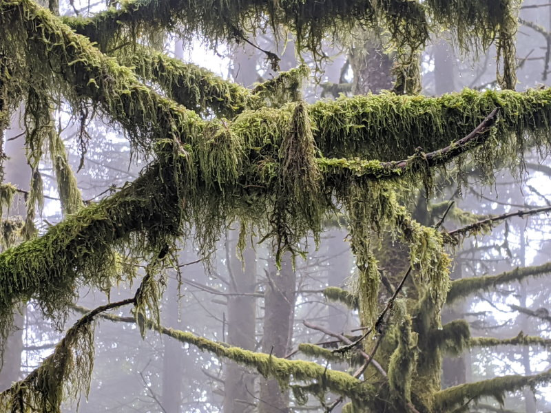
Twin Falls - Easy
This waterfall is insanely popular and has a very small viewing area, so try to plan accordingly. The trail runs along a stream and has lots of mossy trees that really come to life when they are wet. I would argue that this trail is even pretties in the rain. Check conditions on WTA.
Heather Lake - Easy to Moderate
This is a beautiful lake with a boardwalk, allowing you to explore it and get the views from all sides. If you drive up this is a short easy hike, but the road up there has some pretty big potholes, so I usually park below and walk up. Check conditions on WTA.
3 Best Short (Under 5 miles) - In Order of Difficulty
Snoquera Falls - Easy to Moderate
This stunning waterfalls is a pretty hike with the option to make it a loop or an out and back (easier). See my trip report for more details and tips. Check conditions on WTA.
Winchester Mountain - Moderate
This mountain has stunning mountain views, beautiful lakes below it, and a historical fire lookout to explore. You need an off-road capable vehicle to get up to the trailhead, unless you are willing to tack on some extra miles. Check conditions on WTA.
Poo Poo Point
We have enjoyed this beautiful trail on both rainy and clear days. Last time we went we had a clear view of Rainier and paragliders taking to the sky. Find the trail here.
3 Best Challenging but Worth it Adventures - In Order of Difficulty
Mount Saint Helens
Summiting St Helens when the mountain is snow free is a non-technical endeavor, but requires a permit April - November. There is no reliable water on the mountain so you must carry everything you need. The last 1000 feet are in deep ash that makes you do double the work for every foot you climb, but the view at the crater is spectacular. Check conditions on WTA.
Camp Muir - Mount Rainier Base Camp
This hike requires some glacier/snow travel and hiking at altitude. It is not a technical hike, but does require some preparation and gear. On a good day the views are great, but the weather can shift quickly and is unpredictable. Check conditions on WTA.
Enchantments Through Hike
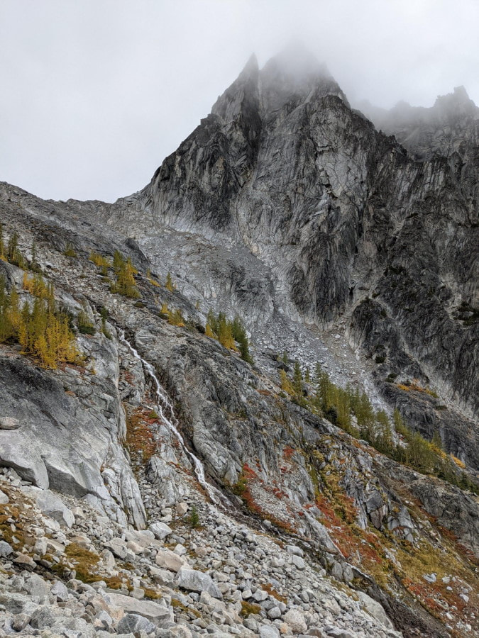
It is a hauntingly beautiful otherworldly landscape. This area has a paid lottery for backpacking permits, with only about a 2% chance of winning. For everyone who doesn’t get a permit, you are still welcome to make a day trip, but it is a leg burning/knee busting trip with a decent amount of moderate scrambling. See my trip report for more details and tips. Check conditions on WTA.
3 Best Waterfalls - In Order of Difficulty
Twin Falls - Easy
This waterfall is insanely popular and has a very small viewing area, so try to plan accordingly. The trail runs along a stream and has lots of mossy trees that really come to life when they are wet. I would argue that this trail is even pretties in the rain. Check conditions on WTA.
Snoquera Falls - Easy to Moderate
This stunning waterfalls is a pretty hike with the option to make it a loop or an out and back (easier). See my trip report for more details and tips. Check conditions on WTA.
Marshel Falls - Easy to Moderate
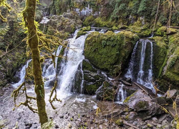
These waterfalls may look small, but they are really quite large. There are three different areas to explore and I recommend giving them all a shot. On a wet day they feel like something out of Lord of the Rings and you can even get behind one of them. If you can get some of the limited shoulder parking this is a very short hike, but most people start from the parking area and walk along the forest roads to get here. Trying to follow some of the written directions from the main parking this one can feel like a treasure hunt, so I highly recommend plotting a course on a GPS app ahead of time. Check AllTrails activities for some options.
3 Best Backpacking Adventures - In Order of Difficulty
Twin Lakes - Easy to Moderate
When we visited in September the colors were vibrant, there were plentiful berries, and a few wildflowers were still hanging on. This area far surpassed my expectations, but it is not the easiest to get to. I have details and videos here.
Park Butte & Railroad Grade - Moderate
I make a trip here every year. You can do this as a day hike, backpack to the foot of the glacier on Railroad Grade, or try your luck at staying in the Park Butte Fire Lookout! This area is always beautiful, but in the fall the exposed blue glaciers contrasting against the fall colors is really worth a trip! Click here for our how to and options for this area. Check conditions on WTA for Park Butte and Railroad Grade.
Chelan Lakeshore - Moderate to Hard
Lake Chelan is a narrow strip of icy blue water surrounded by snow-cover peaks and it reminded me of a fjord. Trailhead access is by boat only, and a reservation is needed, so a little planning is required. Our article includes a video and details a number of options for exploring this area.
3 Best Hidden Gems - In Order of Difficulty
Eightmile Lake - Easy to Moderate
The Enchantments is a wildly popular hiking area, but the Eightmile Caroline Zone seems to be a bit of the ugly duckling. As the least loved area it is the easiest to get overnight permits for and the best if you are looking to avoid the crowds. It offers views of a glacier, jagged mountain peaks, clear alpine lakes, and vibrant meadows. I have details and videos here. Check conditions on WTA.
High Pass - Moderate to Hard
When we visited in September the colors were vibrant, there were plentiful berries, and a few wildflowers were still hanging on. On our entire hike on a beautiful weekend day we only saw two other groups. This area far surpassed my expectations, but it is not the easiest to get to. I have details and videos here. Check conditions on WTA.
Greider Lakes - Moderate to Hard
Even on a rainy day this place was special. The trail takes you around the reservoir, up through a mossy forest with tons of mushrooms, then delivers you to the upper lake with mountains towering over it. See my trip report for more details and tips. Check conditions on WTA.
Bonus - Best Overall
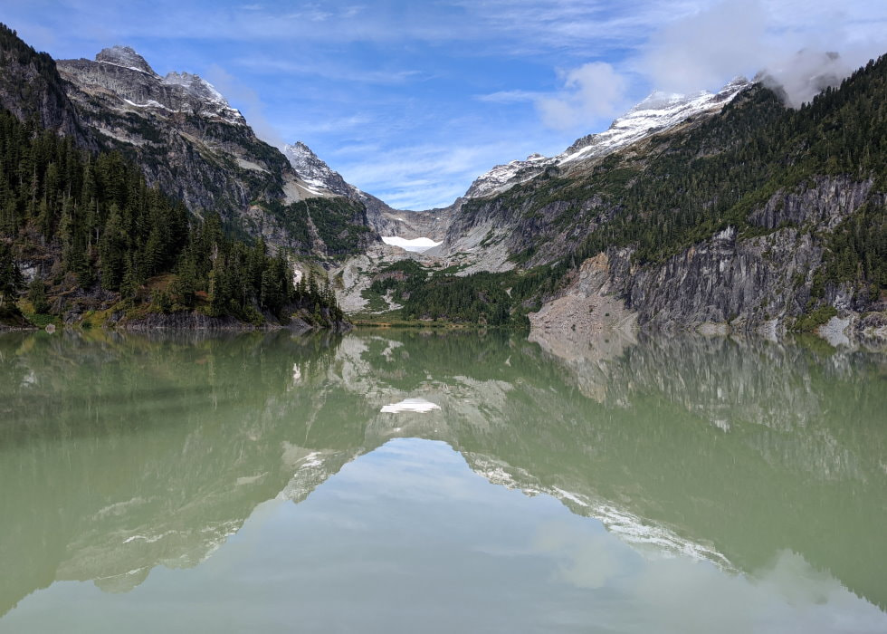
Hidden Lake - Moderate to Hard
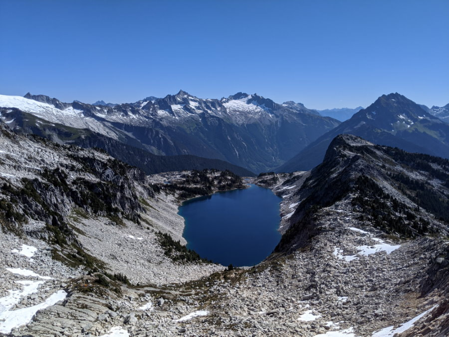
Just incredible! This is one of the best I have done, not just in Washington, in the world! The trail takes you through at least four completely different ecosystems and the mountain views are incredible. In the summer the wildflowers are beautiful. At the top you get glacier views, an alpine lake, and a fire lookout all in one spot. Check conditions on WTA. Check the wildflower map if you want to see the bloom.
Product Links: I am not sponsored by any of the products I link to. If you choose to make a purchase from one of the links of a product I listed or any other item a small percentage will go back to me to fund this website, at no additional cost to you. The products I link to are either ones I have used or similar if those are not available. Thank you for your support.
More?
Check out more incredible Washington Hikes
Experience the flowers in Southern California
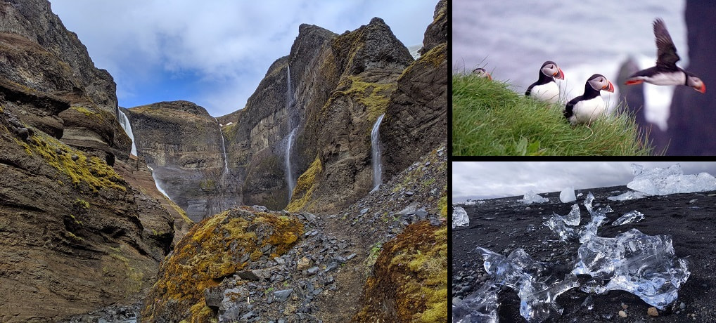
For our journey around Iceland see my full Trip Itinerary & Travel Budget.