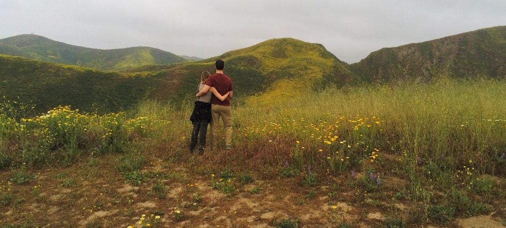
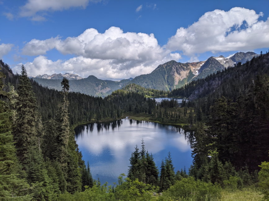
Of the couple hundred miles we hiked in 2020 only 10 of those miles were without our pup. Washington is home to three incredible National Parks and several other recreation areas that prohibit dogs, but there is so much more! These are some of my top picks for dog friendly hikes without sacrificing the views.
You can use this interactive map to find hikes by location and/or the descriptions below to find the right fit for your skill level and interests. On the map the blue markers indicate the recommended hikes listed below and the squares indicate other hikes that didn’t make the cut, but may be worth checking out while you are in the area.
Contents
Check out below for more details, local attractions, and links to full articles on many of the hikes. If there isn’t an article yet Subscribe to the Newsletter to be notified when it is published or request it in the comments at the bottom.
Rating Key:
Trail Ratings: Based on summer, snow free conditions
- Easy - Mostly flat ground
- Moderate - Hikes with elevation change
- Hard - Long hikes with significant elevation gain and/or difficult terrain
Road Ratings: It is best to check trip reports for current conditions, especially for dirt roads
- Easy - All or mostly paved road
- Moderate - Some dirt or gravel road, but doable for most vehicles (video example)
- Hard - Vehicle with good ground clearance recommended (video example)
You can find our full collection of trailhead road videos on our Washington Trailhead Road Playlist.
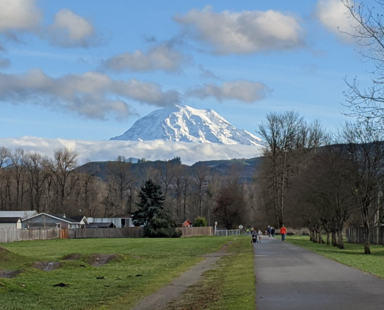
- Norse Peak - Wildflowers, View of Rainier, Burnt Forest
- Moderate to Hard Trail
- Easy Road
- Summit Lake & Bearhead Mountain - Alpine Lake with a View of Rainier, Wildflowers
- Moderate Trail
- Moderate to Hard Road
- Foothills - Berries, Mountain and River Views
- Easy Trail
- Easy Road
- Poo Poo Point - Mountain Views with Paragliders
- Moderate Trail
- Easy Road
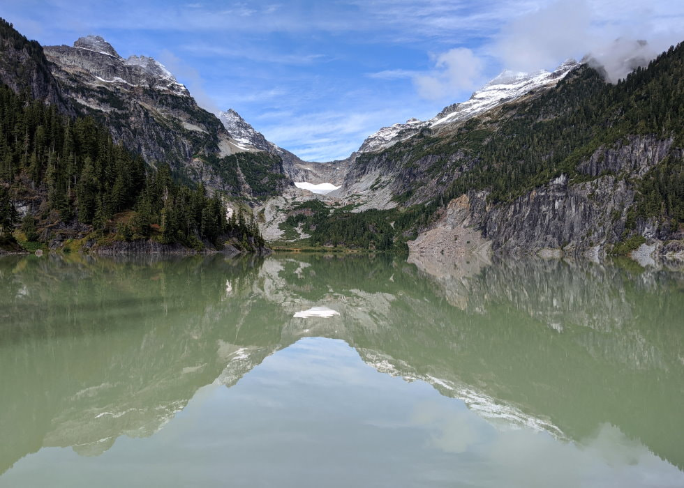
- Blanca Lake - Mountain Ringed Alpine Lake
- Moderate Trail
- Moderate Road
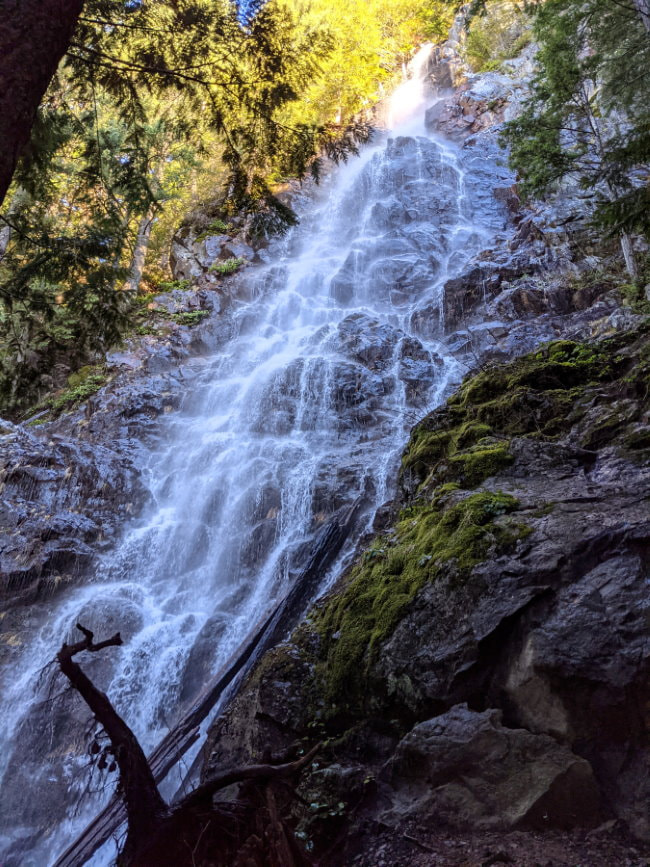
- Mount Teneriffe - Waterfall, Mountain Views
- Moderate to Hard Trail
- Easy Road
- Hidden Lake Lookout - Mountain Views, Wildflowers, Alpine Lake, Fire Lookout
- Hard Trail
- Hard Road
- Park Butte - Mountain Views, Fire Lookout, Berries, Mushrooms
- Moderate Trail
- Moderate Road
- Heather Maple Pass - Mountain Views, Alpine Lake, Wildflowers, Fall Foliage
- Moderate Trail
- Easy Road
- Watson Lakes - Alpine Lakes
- Easy to Moderate Trail
- Moderate Road
- High Pass & Winchester - Mountain/Lake Views, Berries, Fall Foliage, Fire Lookout
- Moderate to Hard Trail
- Moderate to Hard Road
- Chelan Lakeshore - Mountain Views, Wildflowers, Lake Views
- Moderate Trail
- Easy Road (ferry required)
- Mount Ellinor - Panoramic Mountain Views
- Moderate to Hard Trail
- Moderate Road
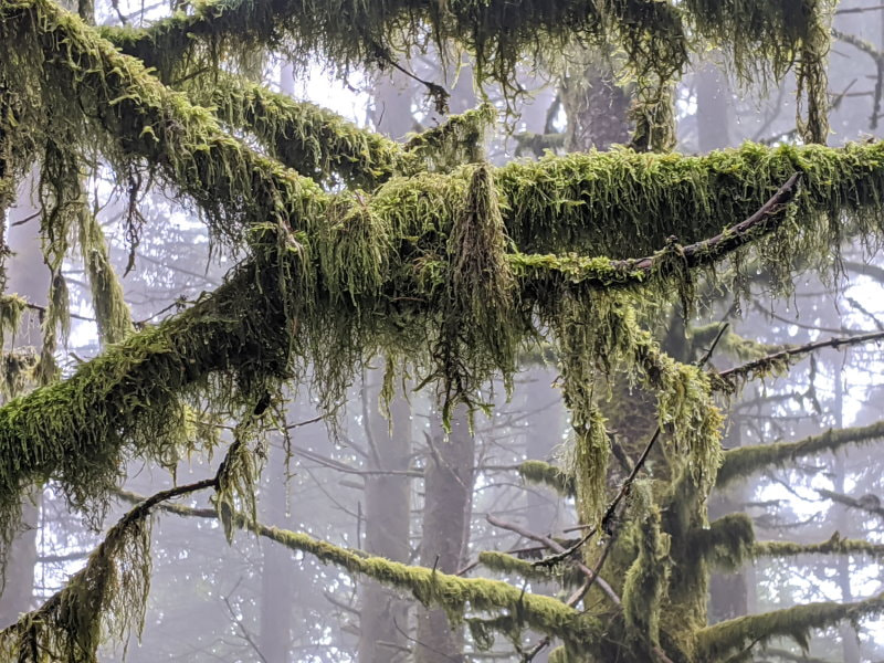
- Big Quilcene River - Peaceful Canyon River Lined with Mosey Trees
- Easy to Moderate Trail
- Easy to Moderate Road
- Double Bluff Beach - Mountain and Ocean Views
- Easy Trail
- Easy Road
You can find where we have been hiking lately in my WTA Trip Reports.
What pass do I need?
Check out Washington Trail Association’s article: Recreation Passes and Permits
What else do I need to bring?
The Basics - Good to have on any hike
Greater Rainier Area
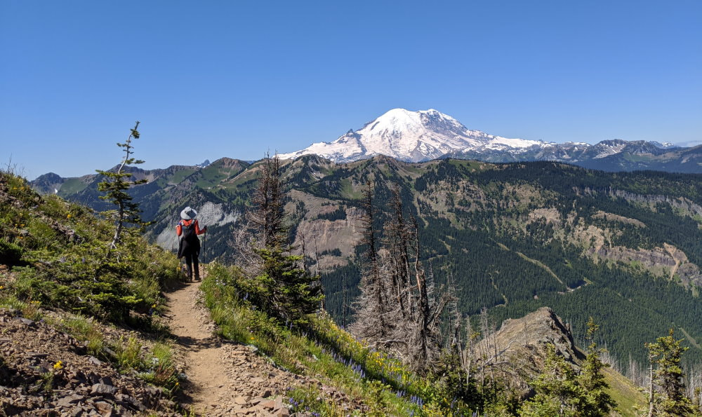
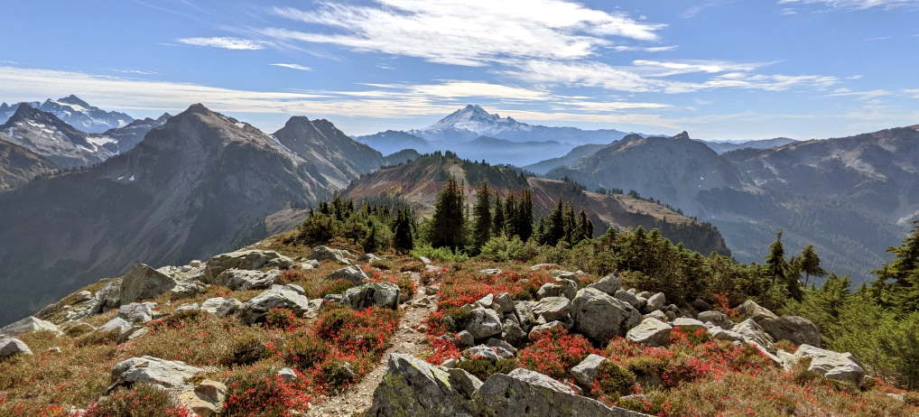
Norse Peak - Wildflowers, View of Rainier, Burnt Forest
- Moderate to Hard Trail
- Easy Road
- 10 miles out and back
- 2900 ft Elevation Gain
- Best time to visit is July for wildflowers
- Need a pass - US Forest Services
Hazards:
- Some narrow sections
- Some misleading trails
- Full sun for over 50% of the trail
- No water
Road/Parking: Parking is right on a paved road
The Experience:
Want to walk along a trail lined with wildflowers, gaze at Mount Rainier, and pass through the ghostly remains of a burnt forest? This area saw a wildfire in 2017 that cleared some spectacular views and made way for the sun to reach the ground, allowing numerous varieties of flowers to flourish. Check out the Norse Peak full article for details. Check the wildflower map if you want to see the bloom.
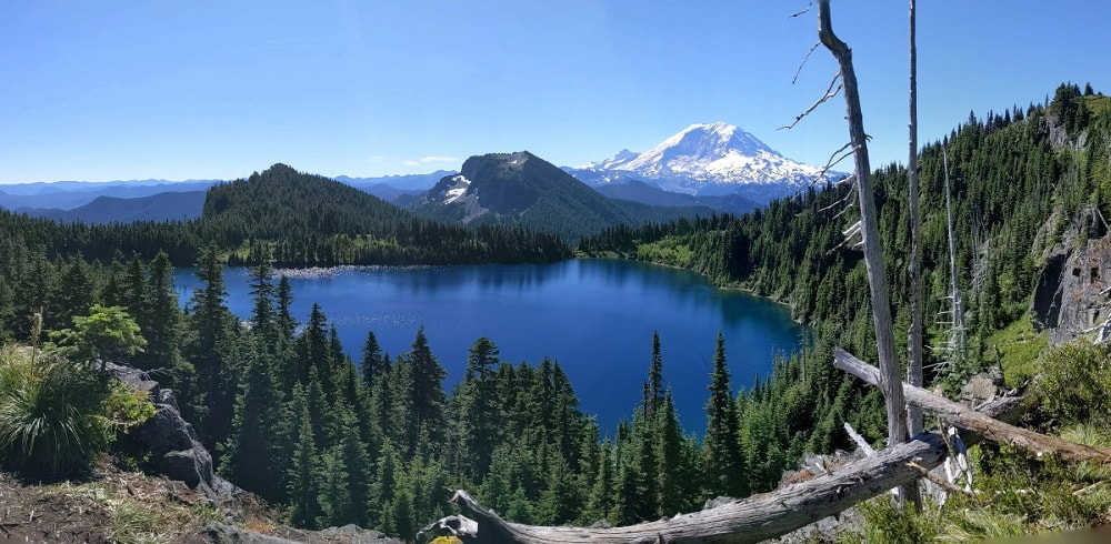
Summit Lake & Bearhead Mountain - Alpine Lake with a View of Rainier, Wildflowers
- Moderate Trail
- Moderate to Hard Road
- Summit Lake - Roughly a 6 mile loop to go around the lake with 1300 ft elevation gain
- Bearhead Mountain - 6 mile out and back with 1800 ft elevation gain
- Summit Lake & Bearhead together - Roughly 11.5 miles
- Best time to visit is July, August, & September
- Need a pass - US Forest Services
Hazards:
- Steep drop offs at viewpoints
- Rough road with logging activity
- You might not want to leave
The Experience:
Crystal clear water, stunning views of Mount Rainier, plentiful wildflowers, mountain summit with panoramic views, and peaceful forest trail! This hike has it all, just make sure you are prepared for what it takes to get there! Check out the Summit Lake & Bearhead Mountain full article for details and a video of the drive in. Check the wildflower map if you want to see the bloom.
Foothills (Orting Section) - Berries, Mountain and River Views
- Easy Trail
- Easy Road
- Mostly paved
- Perfect year round
- No pass required
Hazards:
- Colliding with faster moving wheeled vehicles on the paved portion
Road/Parking: Multiple paved parking areas to choose from and if they are full just find a spot downtown and walk over.
The Experience:
The Foothills trail goes for many miles, but I like to make a loop out of a section that runs through Orting. I take the paved trail (starting downtown or at the skate park) to the intersection with the gravel river trail and cutting back through town whenever I get tired. This is a nice walk any time, but if you can find a summer day when the local farm market is open and the mountain is visible, it is perfect. Pick up a snack at the market and go for a stroll. If the market isn’t open there are still plenty of places in town to grab a bite before or after your walk.
Central Cascades
Snoqualmie Pass I-90 - North Bend has lots of good places to grab a bite to eat, an interesting train park, and a scenic waterfall nearby.
Stevens Pass Route 2 - Monroe’s Main St has a quaint feel to it and many dining options.
Poo Poo Point (Chirico Trail) - Mountain Views with Paragliders
- Moderate Trail
- Easy Road
- 4 mile out and back
- 1760 ft Elevation Gain
- Toilets at trailhead
- Best time to visit is on a clear day year round
- Public transit is sometimes available
- No pass required
Hazards:
- Slick when wet or icy
Road/Parking: Large gravel lot right off the main road. This is a popular spot and it does fill up. There is a $5 paid lot across the road that accepts Venmo and cash.
The Experience:
We have enjoyed this beautiful trail on both rainy and clear days. Last time we went we had a clear view of Rainier and paragliders taking to the sky.
Blanca Lake - Alpine Lake
- Moderate Trail
- Moderate Road
- 8 miles out and back
- 3300 ft Elevation Gain
- Best time to visit is any time the trail is snow free
- Need a pass - US Forest Services
Hazards:
- Slipping on logs at the lake
- Getting lost on the drive back
Road/Parking: Required a detour due to frequent road closures. Check out the full article for details.
The Experience:
This is one of those shady trails that is perfect to shield you from the sun on a summer day, or even the rain. The mountain ringed lake at the end with its unique coloring is well worth the trek to see it. Check out the Blanca Lake full article for details.
Mount Teneriffe - Waterfall, Mountain Views
- Moderate to Hard Trail
- Easy Road
- 11 mile loop (Kamikaze up, Mount Teneriffe down )
- 4000 ft Elevation Gain
- Toilets at trailhead
- Best time to visit is on a clear day year round, but check snow conditions
- Need a pass - State Park
Hazards:
- Over 1000 ft drop to one side at the peak
- Kamikaze trail is steep and not well marked
- Some rock scrambling
Road/Parking: Paved lot
The Experience:
This hike is mostly tree covered, with just small glimpses here and there, so when you pop out of the trees at the top it takes your breath away. On a clear day you can see Seattle and all the way to the Olympics. There are several possible routes, with Kamikaze being the more challenging by far and in my opinion the most fun. Check out the full article for details.
Northern Cascades
Bellingham - Makes a nice base if you are looking for somewhere urban. It is a charming city with a large variety of food options.
Northern Cascades Highway Route 20 - The town of Concrete has an unmissable town sign and many dining options. If you pass Diablo Lake there is paved lot at the lookout with toilets.
Hidden Lake Lookout - Mountain Views, Wildflowers, Alpine Lake, Fire Lookout
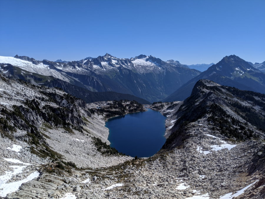
- Hard Trail
- Hard Road
- 8 miles out and back
- 3300 ft Elevation Gain
- Best time to visit is late summer
- Need a pass - US Forest Services
Hazards:
- Getting stuck in potholes
- Treacherous climb to the lookout (the trail to the lake is fine)
- Crossing the snow patches that linger year round
Road/Parking: Quite rough, our Forester scraped a couple times.
The Experience:
Just incredible! This is one of the best I have done, not just in Washington, in the world! The trail takes you through at least four completely different ecosystems and the mountain views are incredible. Check the wildflower map if you want to see the bloom.
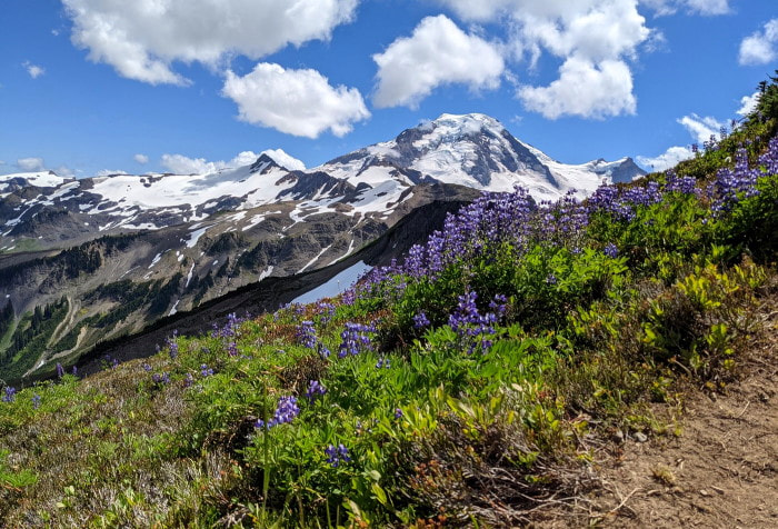
Park Butte - Mountain Views, Fire Lookout, Berries, Mushrooms
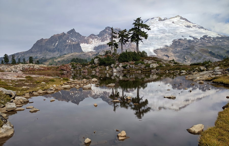
- Moderate Trail
- Moderate Road
- 7.5 miles out and back
- 2200 ft Elevation Gain
- Toilets at trailhead
- Best time to visit is summer or fall
- Need a pass - US Forest Service
Hazards:
- Water crossings
- Summit fever, it is so close!
Road/Parking: Limited parking at the end of a 15 mile dirt/gravel road.
The Experience:
This incredible hike has views most of the way and lots to see! At the lookout Mount Baker feels like just a skip across the valley. The lookout balcony is suspended on the edge of a dizzying cliff, but if you can get over the heights this is an unparalleled lunch spot. Don’t worry, other than the lookout this trail is pretty mild in terms of heights and there are plenty of other less intimidating spots. Check out the Park Butte Lookout full article for details on how to stay the night up there.
Heather Maple Pass - Mountain Views, Alpine Lake, Wildflowers, Fall Foliage
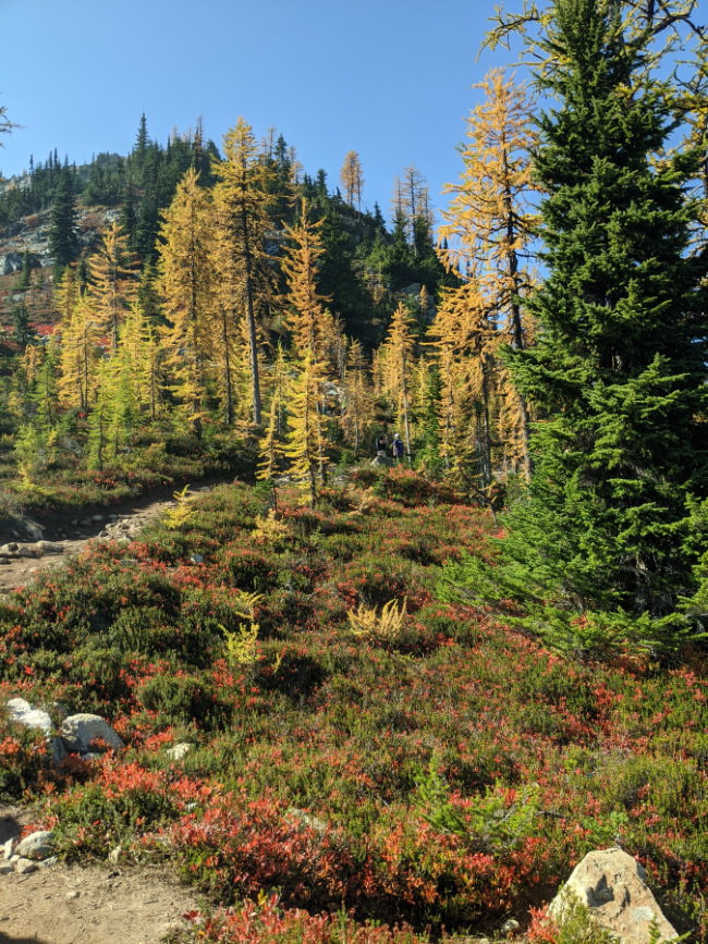
- Moderate Trail
- Easy Road
- 7 mile loop
- 2000 ft Elevation Gain
- Toilets at trailhead
- Best time to visit is summer or fall
- Need a pass - US Forest Services
Hazards:
- Finding your car when you finish
Road/Parking: Plenty of roadside parking but you may end up a mile away in the fall!
The Experience:
The first mile of this hike was a traffic jam, but after that the herd thinned and it was pleasant. Beautiful scenery in all directions and if you have never seen larches (the deciduous “pine” trees that turn gold in the fall) this is a great spot.
Watson Lakes - Alpine Lakes
- Easy to Moderate Trail
- Moderate Road
- 3-6 miles out and back
- 1000 ft Elevation Gain
- Toilet at trailhead
- Best time to visit is summer or fall
- Need a pass - US Forest Services
Hazards:
- Rough trail after the second lake
Road/Parking: Over 12 miles of rough road driving but not horrible. See the videoT for a bit of what to expect.
The Experience:
Something about the mountains and the reflections here make these lakes really special. The trails to Anderson Lakes are an easy walk complete with some boardwalks and a little up and down, the first Watson Lake requires a little elevation change going over a ridge, and the far side of the second Watson Lake is barely a trail, but worth it. Check out the Watson Lakes full article for details.
High Pass & Winchester Mountain - Mountain/Lake Views, Berries, Fall Foliage, Fire Lookout
- Moderate to Hard Trail
- Moderate to Hard Road
- 2.5 - 10 mile trail options
- 1500+ ft Elevation Gain
- Toilet at trailhead
- Best time to visit is summer or fall
- Need a pass - US Forest Services
Hazards:
- Some trail sections are narrow, slippery, and/or rocky
- Mosquitos & Flies - summer
- Smoke and Wildfire - possible late summer to early fall (I carry a good mask)
Road/Parking: The road up to the Yellow Aster Butte Trailhead is rough and best in a SUV, but is possible in a car. The parking is all roadside. You can see some of the road in this video.
The road beyond that is shown on some maps as a road and on others as a trail. It is virtually unmaintained and you need a serious vehicle to handle it. The road is narrow and has lots of hairpin corners, some that require multi point turns.
The Experience:
This adventure had phenomenal mountain views and stunning lakes, laced with delicious berries. We found solitude on High Pass and friendly comradery everywhere else. The fall colors were particularly spectacular. Check out our High Pass & Winchester Mountain full article for details on hiking, camping and backpacking there.
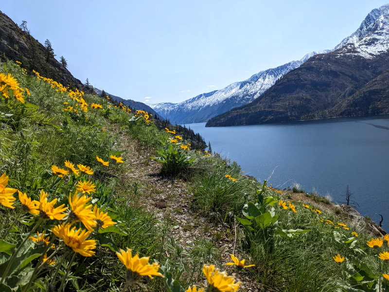
Chelan Lakeshore - Mountain Views, Wildflowers, Lake Views
- Moderate Trail
- Easy Road - ferry required
- 18 miles one way
- 4000 ft Elevation Gain - but not all at once
- Dog friendly
- Best time to visit is spring through fall, check reports for conditions
- No park pass needed
- Bathroom (full pit toilet) at trailhead and some campsites
- No cell phone service including in Stehekin
Hazards:
- Rattlesnakes (we saw one)
- Ticks
- Some trail sections are a little close to the edge
- Some rock hopping required for crossing seasonal streams
- Tree falls to negotiate, especially in early spring
Road/Parking: Paved road all the way to the ferry. There are two ferry options and you may need to purchase an overnight parking pass.
The Experience:
This thru-hike was my first-ever true backpacking trip and it was fantastic! Lake Chelan is a narrow strip of icy blue water surrounded by snow cover peaks and it reminded me of a fjord. This is not a beginner hike, but the campsites have a lot of amenities that make backpacking easier and allow for a lighter pack. Trailhead access is by boat only, and a reservation is needed, so a little planning is required. Check out the Chelan Lakeshore full article for details. Check the wildflower map if you want to see the bloom.
Olympic Peninsula
Mount Ellinor - Panoramic Mountain Views
- Moderate to Hard Trail
- Moderate Road
- 6.3 miles out and back to the lower trailhead
- 3300 ft Elevation Gain
- Best time to visit is summer or fall
- Need a pass - US Forest Services
Hazards:
- Steep trail with loose rocks and dirt
- Lots of sun
- Could get licked by a mountain goat (but we didn’t see any)
Road/Parking: Long dirt/gravel road in decent condition with small parking areas at the lower and upper trailhead.
The Experience:
The steep climb up what may seem like endless stairs brings you to a summit with lush green lake views to one side and snowcapped mountains on the other. It really feels like you are right on the edge of the mountain range. There used to be lots of mountain goats in the area, but many have been relocated. Check out the Mount Ellinor full article for details.
Big Quilcene River - Peaceful Canyon River Lined with Mossy Trees
- Easy to Moderate Trail
- Easy to Moderate Road
- 1-20+ miles out and back, but can turn back at any time
- Minimal Elevation Gain
- Toilets at trailhead
- Best time to visit is year round, but check snow conditions
- Need a pass - US Forest Services
Hazards:
- A couple narrow sections
- Deciding when to turn back
Road/Parking: There are a few rough spots but the road isn’t too bad and has a tiny gravel lot.
The Experience:
This is the kind of trail you do not for some great lookout, but rather the experience. This trail meanders along the river through a canyon with beautiful huge mossy trees and clear blue water. Enjoy the sound of the rushing water and find a rock to just sit and reflect for a minute. This trail stretches for miles, so turn around whenever you have had your fill.
Whidbey Island
Double Bluff Beach - Mountain and Ocean Views
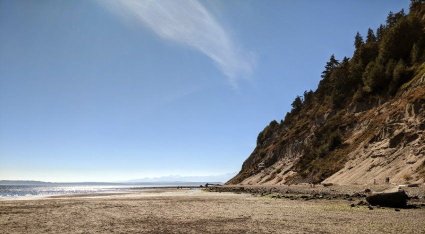
- Easy Trail
- Easy Road
- Up to 4 mile beach walk
- Toilet and rinse station near parking lot
- Best time to visit is year round
- No pass required
Hazards:
- Kids sliding down the bluffs
- Rough waves
Road/Parking: Limited parking but plenty of space along the road
The Experience:
Walk barefoot and feel the sand and water on your toes while gazing at a panorama of Mount Rainier, the Northern Cascades, and the Olympic Peaks. Dogs run free here and get to play in the water too.
Product Links: I am not sponsored by any of the products I link to. If you choose to make a purchase from one of the links of a product I listed or any other item a small percentage will go back to me to fund this website, at no additional cost to you. The products I link to are either ones I have used or similar if those are not available. Thank you for your support.
More?
See our pick for the Best of Washington
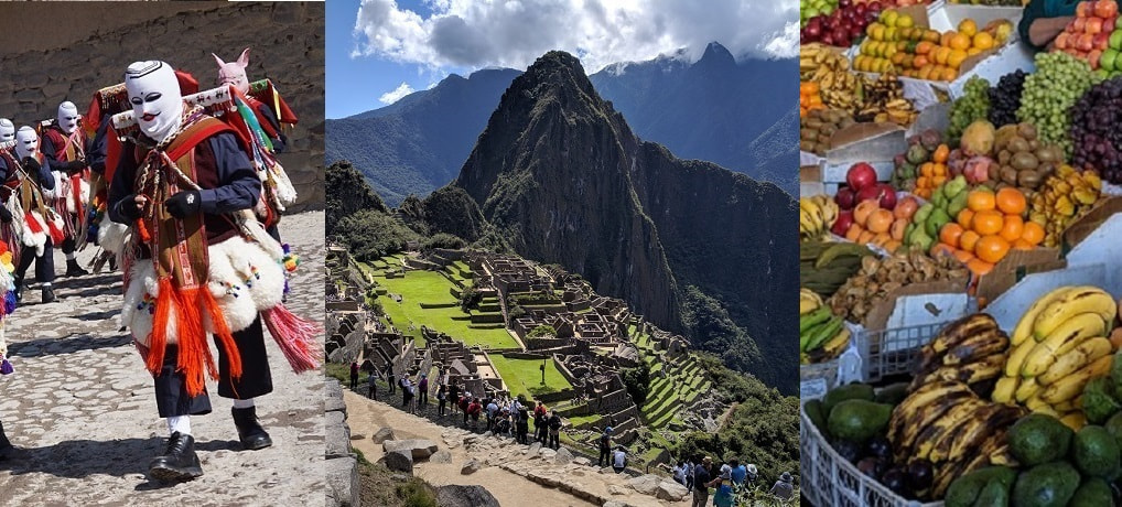
Check out our full Peru Trip Itinerary.
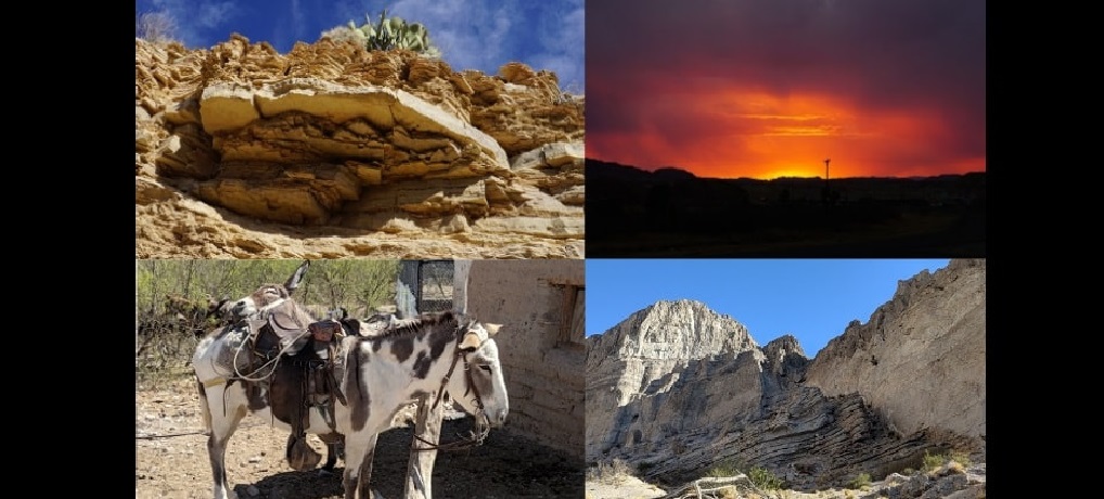
See our full Big Bend Trip Itinerary
Experience the flowers in Southern California