Mount Ellinor
The steep climb up what may seem like endless stairs brings you to a summit with lush green lake views to one side and snowcapped mountains on the other. It really feels like you are right on the edge of the mountain range. There used to be lots of mountain goats in the area. Many have been relocated, but you never know.
Trail Head: Olympic Peninsula - Hood Canal Route 101
GPS Coordinates: 47.506883, -123.231700 Map
Trail Notes
- Moderate to Hard Trail
- Moderate Road
- 6.3 miles out and back to the lower trailhead (3.8 from upper)
- 3300 ft Elevation Gain lower trailhead (2300 ft from upper)
- Best time to visit is summer or fall
- Dog friendly
- Toilets at upper trailhead only
- Need a Pass - US Forest Services (see Recreation Passes and Permits for options)
Hazards
- Steep trail with loose rocks and dirt
- Lots of sun
- Could get licked by a mountain goat (but we didn’t see any)
Road/Parking
Long dirt/gravel road in decent condition with small parking areas at the lower and upper trailhead. Check out a clip of what the road is like here.
The Experience
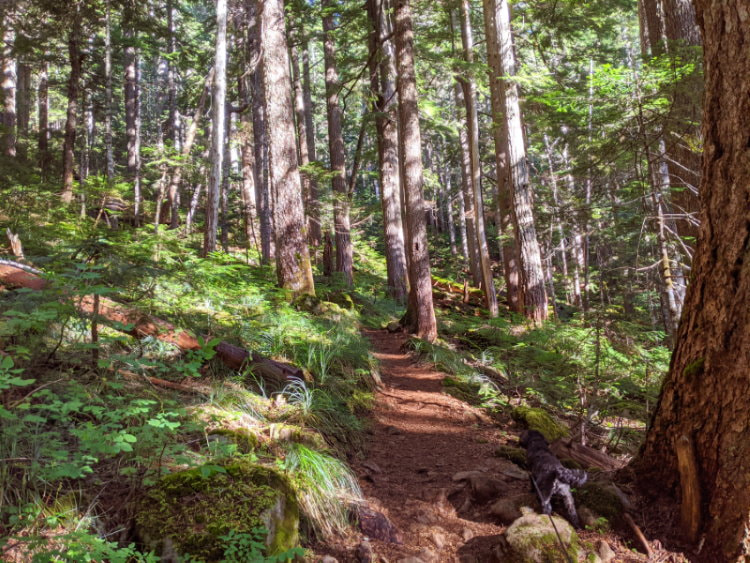
We started at the lower trailhead to get the full experience and get to enjoy some time in the shade below the treeline. As soon as we entered the forest here we noticed that it somehow just felt a little different. It had the moss and huge trees that are everywhere in the Pacific Northwest, but there was something else. A softness to it and a bit of a red glow. I felt like if I yelled the forest would somehow muffle the sound to a whisper, even though there was very little undergrowth and the space felt large and open. The ground was carpeted in needles that turned our footfalls into a faint russel. The air hung damp, warm, and earthy, with a hint of evergreen. We walked through it in silence and tried to take it all in.
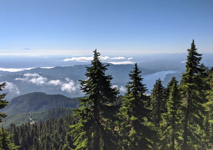
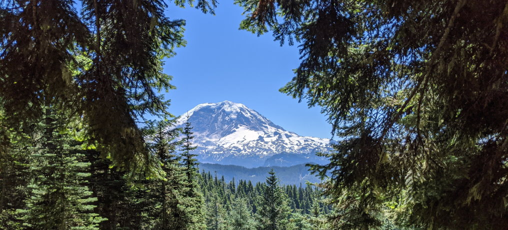
Soon the trees stated to thin and the anticipation of what was around the next corner overcame our desire to stay in that space. As we climbed above the trees, Rainier came into view in the distance. I have climbed many of the mountains around Rainier and they are no joke, but when you look from a distance they all just seem to melt away as if they didn’t even exist and Rainier was just standing there alone.
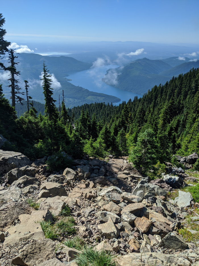
A little higher up we got a view of the sparkling blue water of Lake Cushman. Gazing at it we noticed puffy clouds appear on the surface and drift up towards us as if ghosts emerging from the water. They were interesting, but we thought very little of them until later.
Then we began to truly climb. At over 1000 feet elevation gain per miles you know it is going to be a leg burner when the first mile barely has an incline to it. First it was a steep path through a boulder field. This bit had some water flowing across it in a couple places. Then the trail turned to a long burn up an endless line of stairs to a ridge that appeared to be the top. I honestly thought it was close until I crested the top and saw the next section. There is a cute little bench at the top of the stairs for those, like me, who need a snack to sooth the disappointment and gather energy for the last push.
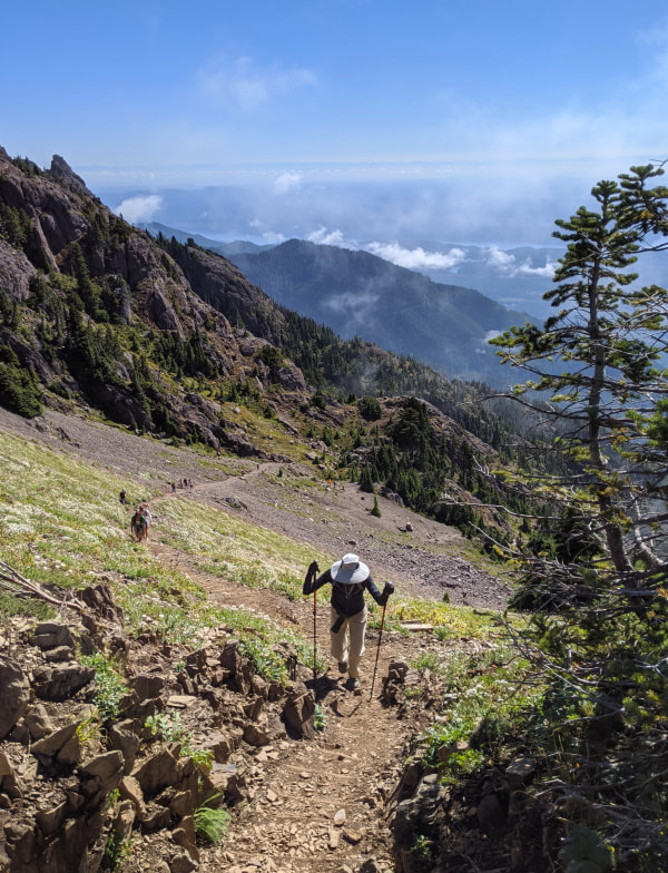
The last section was a mix of stairs and loose dirt. According to the signs it was still under construction and we saw lots of evidence in the form of supplies along the way. The volunteers who brought all that stuff up here are incredible!
Part way up this last section, we ran into one more volunteer. We rounded a corner to see a white haired man in a meadow wielding a butterfly net. He kindly explained that he is part of a study doing a bumble bee count. He had a full setup with a camera and light box to photograph each one he caught. Interesting work, but quite a trek to pester bees and hope they don’t mind and pester you back! We thanked him and moved on quickly in case the bees mistook us for agitators.
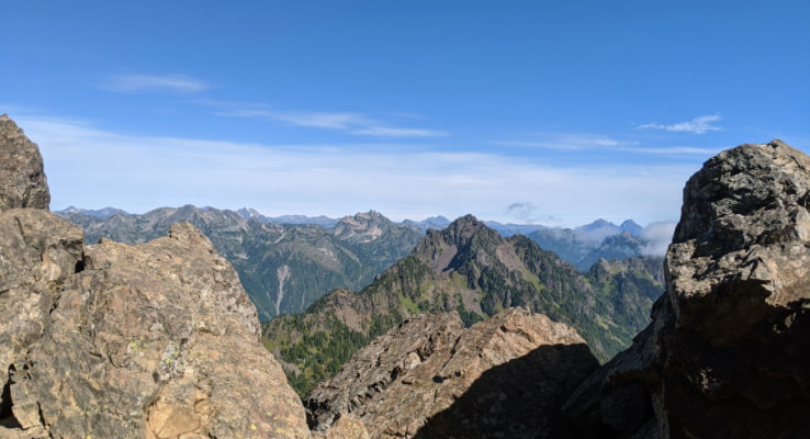
As we crested the top we got a view of the Olympics on the other side and mere minutes later they were gone. Those fluffy little clouds had caught up with us and blanketed the entire mountain top. It was crazy how fast they moved. As we sat and ate our lunch every now and then they would part for a moment, reveling a glimpse of the surroundings and then close right back in again. Although brief, we were very lucky to get a view at all and would have missed it entirely if we had been even 5 minutes later. What we saw was the stark difference between the rocky mountains to one side and the green expanse with rolling hills to the other. We felt like this mountain was right on the dividing line between the two worlds.
For the way back down we decided to investigate the winter trail and see if it was possible to make a loop instead of going back the way we came. There was a bit of a trail over that direction, but it quickly disappeared and left us completely reliant on the GPS track.
It was a rough track with lots of steep terrain, like the other trail, but without the stairs. The easier part was across a boulder field, which was annoying to walk on since the jumble of rocks were rounded and all of them wanted to move. It felt like trying to walk across the top of a ball pit, except the end goal would not be to flop down on them. We got to a section where the trail descended down a very loose shoot into the mist and decided to turn back. We did see a couple other people head this way and didn’t see them come back so I assume some people do it, but it wouldn’t be my first choice, at least not with low visibility.
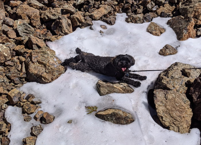
We heard some funny noises and thought it might be the elusive mountain goats, but it was a group of quail. Our dog gave them a suspicious look, but was a bit too hot to try and bother them, so we made a slight detour on our way back to the main trail. I noticed a patch of snow on our way over and he was very pleased with the chance to cool off. He is usually not a fan of the snow, but he seems happy to make an exception when he can have snow and heat at the same time.
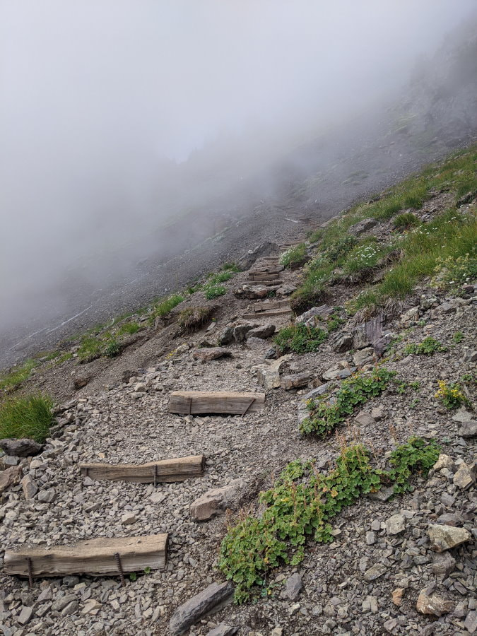
The trip down was mostly uneventful. The fog had completely transformed the trail and it felt much more isolated, as opposed to the bustling trail we had climbed up just hours earlier. The people were still there, you just couldn’t see them until they were in front of you and then they quickly disappeared.
Eventually we climbed down below the clouds just above the tree line and got another look at the lake. We saw a guy here, at the very beginning of his climb, with a shopping bag in one hand looking like he was going on a picnic. I give him a lot of credit if he made it to the summit, but was personally very glad to have my lunch in my pack and hiking poles in my hands. The trail wasn’t particularly hard or technical, but it was a lot of elevation and quite slick in spots.
What to Bring?
-
The Basics - Good to have on any hike
-
Footwear - Solid hiking shoes. There was some water and mud on the trail.
-
Sun protection - A good part of this trail is fully exposed
-
Hiking poles - Especially for the way down. They definitely saved me from a couple painful stumbles.
More Info & Trail Reports
Weather - Mount Ellinor Mountain Forecast
Product Links: I am not sponsored by any of the products I link to. If you choose to make a purchase from one of the links of a product I listed or any other item a small percentage will go back to me to fund this website, at no additional cost to you. The products I link to are either ones I have used or similar if those are not available. Thank you for your support.
More?
Check out more incredible Washington Hikes
Check out some Rochester Gems
See our full Big Bend Trip Itinerary