This half day mini-adventure will take you off the beaten path on a trail just outside town. You will see lots of terraces while hiking along a mountain trail that passes by farms and through a couple backyards. The trail can be a little tricky to follow so read this for directions.
What to expect
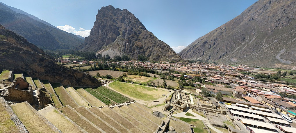
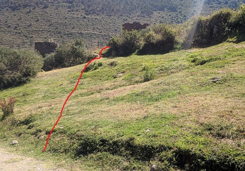
This trail will take you past the Musqa Pukyo Terraces to the Pumarca Ruins (or Pumamarca or Pumamarka). Like many places this site goes by several similar names. Google has it labeled as Pumarca and the trail as Camino de Pumamarca, although the trail isn’t completely accurate. This ruins are not as exciting as the Pinkuylluna Mountain Granaries or the Ollantaytambo Pyramid Ruins, but it is a pretty hike in the mountains with almost no people and you get to see a bit of how people live. If you have trouble with heights, there are a couple spots that may bother you a bit (the worst shown in the image above), but nothing remotely dangerous. There is some up and down, a couple spots with mud, loose gravel, and small streams to cross. There also are some cattle on and around the trail.
Don’t forget
While this is just outside town it gets remote in a hurry, so don’t forget water and snacks. Most of the trail is fully exposed to the sun. Also bring some soles if you want to go into the Pumarca Ruins at the end of the trail. It isn’t always manned, but when it is the fee is 10 soles per person as of 2018, and they don’t usually have change.
How Much Time?
Depends on which way you go (see options below). We left Ollantaytambo at 8:30AM, hiked the trail and got to Musqa Pukyo at 10:00AM, Pumarca at 11:00AM, left Pumarca at 12, and got back to Ollantaytambo via the road around 1:30PM. This was our first full day at altitude after coming from sea level, so we took it fairly easy and we took a few wrong turns.
Options
- Take a taxi or a moto-taxi both ways
- Take a taxi or Uber there and hike back (down hill)
- Hike on the trail (up-hill going there, down-hill coming back, steeper than the road)
- Walk on the road (up-hill going there, steep at the end to get to the ruins, down-hill coming back)
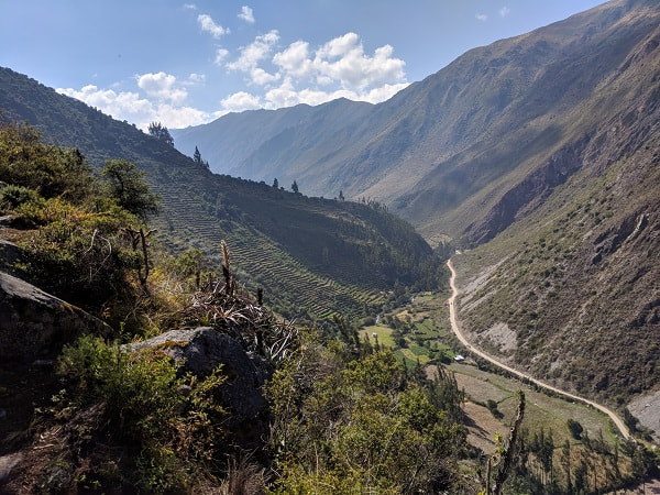
We took the trail there and the road back. The trail is more interesting than the road, but it is nice to see everything from both sides since the trail goes along the top and the road goes along the bottom. The trail is tricky to follow, but the road is almost impossible to get lost on.
Trail Directions
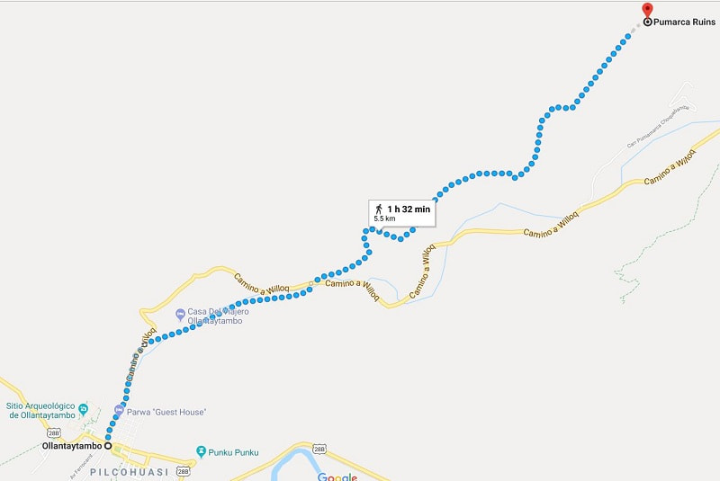
This is the approximate google map trail: https://goo.gl/maps/yvDXbbrQfus I recommend downloading the offline map before going so you can check periodically to make sure you are in the right area. It is not 100% and had the main trail head wrong when we did it, but it is close. Per google the trail is 5.5 km (3.4 miles) and climbs up 600 meters (2000 ft) one way.
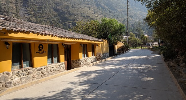
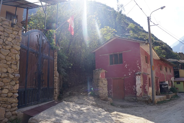
Head out of town on Camino Willoq, which follows the Patacancha River. The river will turn away from the road and you will pass Mama Simona Hotel on your left.
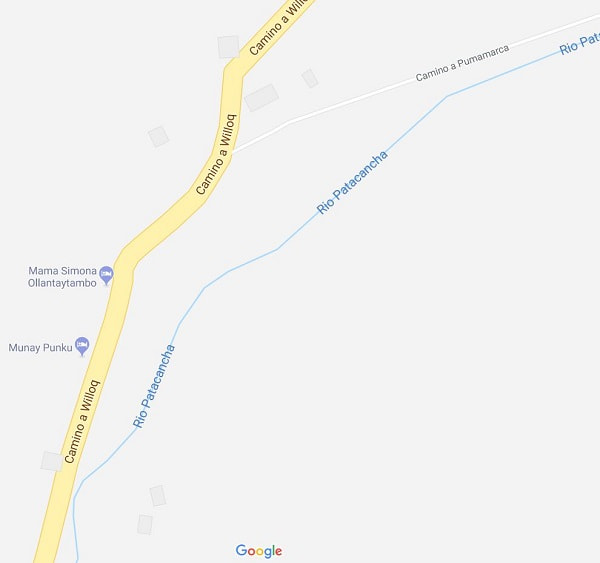
Just past the hotel you will see a gravel trail/road on your right. This trail head does lineup with the trail on Google Maps. You can take this (I recommend it) or stay on the road until the next trail head.
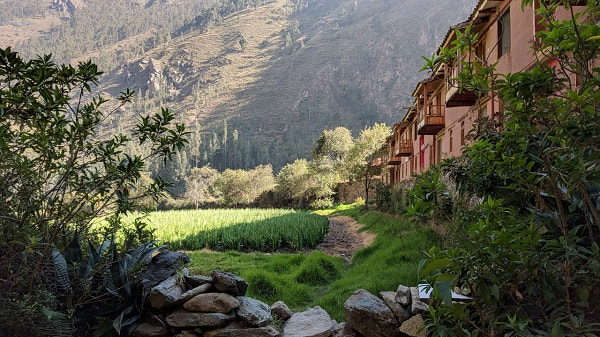
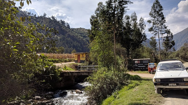
This section of the trail will take you by several people’s homes. We saw pigs and chickens and passed a family playing a game in the road. There were several gated bridges crossing the river that babbled along the trail. The area felt safe but poor. In contrast we passed by a large hotel that was vacant when we were there, but had the entire field planted with flowers.
The trail dumped us out on the road where the river crossed road, which is a little different than Google Maps. It may have continued on but we didn’t look.
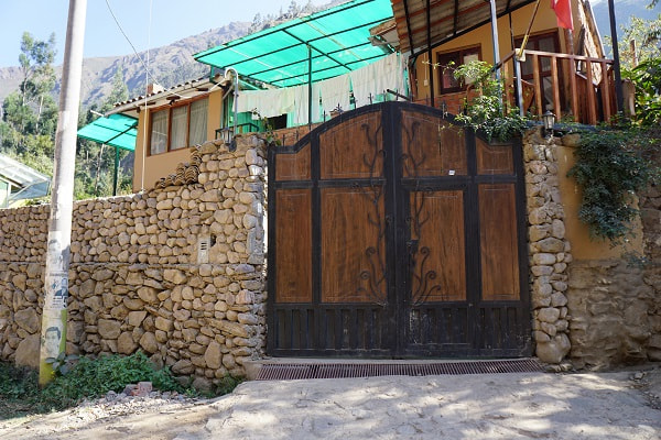
From the road keep an eye out for these houses and there should be a pole right by the second house with the number 36760 on it. The trail is right in the middle there between the houses. This is close, but not quite where Google shows it.
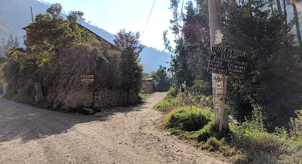
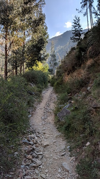
Follow the trail up a gravel trail
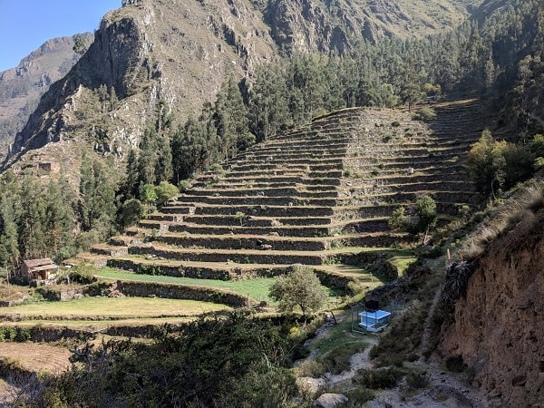
until you get to these terraces and the blue utility cage. Make a sharp turn to the right.
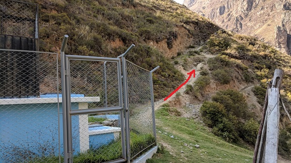
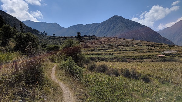
This is the narrowest section of the trail. The picture below and the panorama at the top show this section looking back the way we came from.
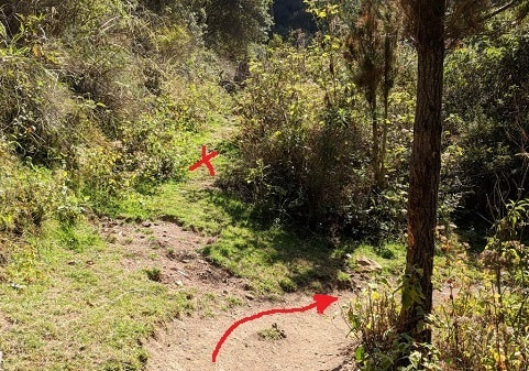
Once you get up a little ways the trail mostly levels out. You will walk along for a bit on a peaceful isolated trail with a view of the mountains. We saw a few birds, some wildflowers, and some interesting seed pods. There are a few other spots where trails cut off to the sides, but just follow the trail straight.
After a bit you will reach the Musqa Pukyo Terraces.
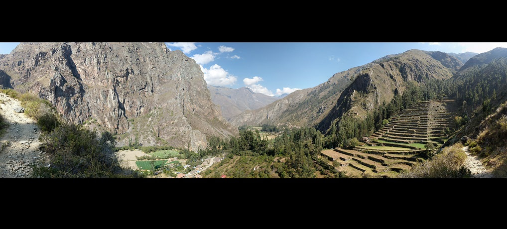
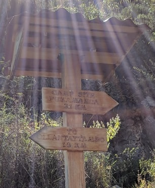
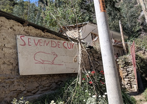
The trail takes you along the top of these terraces. If you take the road back you will get to see them from the bottom. You will pass this sign and keep going. Don’t worry about what the sign says, you are over halfway there!
The trail now passes some homes and farm fields.
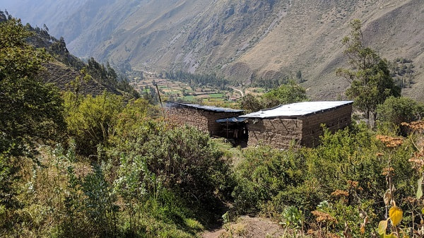
You will cross shallow water/mud in a couple places.
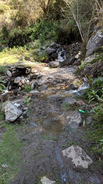
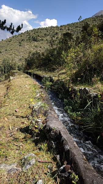
A happily burbling man-made creek will follow the trail for much of this section, channeling the water to homes and fields.
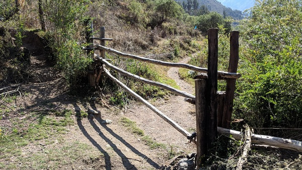
Eventually you will catch your first glimpse of the ruins up on a hill and see this gate. You can climb through or remove the bars to walk through, just be sure to put them back. There were no animals in the field when we were there, but that isn’t always the case.
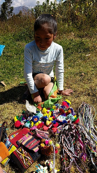
Across the field there may be women or children selling handcrafts and there may be someone collecting the 10 sole fee to visit the ruins. If they are collecting the fee they will give you a ticket.
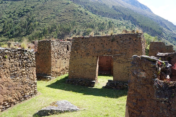
There are multiple ways up to the site and they will all get you there. These ruins are not the most beautiful, but they are nice and usually empty, and have a commanding view of the area. The sun at mid-day was really pretty sparkling off the glasses growing from the tops of the structures.
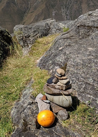
We saw a man praying and make an offering here.
We took the trail on the far left wide of the hill to come back down on the road. At the foot of the hill this girl was waiting for us with her goods.
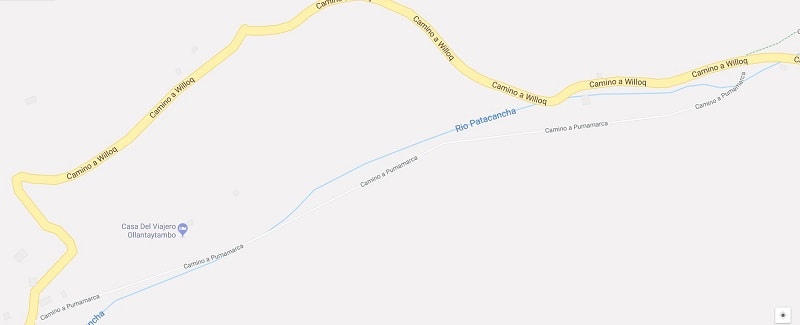
Directions for Following the Road
https://goo.gl/maps/KSMMTYWL7672
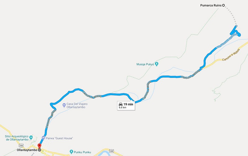
The trail we came down came out here, by a couple stone ruins, near a couple poles, one with a box and one with the number 32992. There really isn’t a wrong way to go as long as you head for the road. Once on the road go downhill.
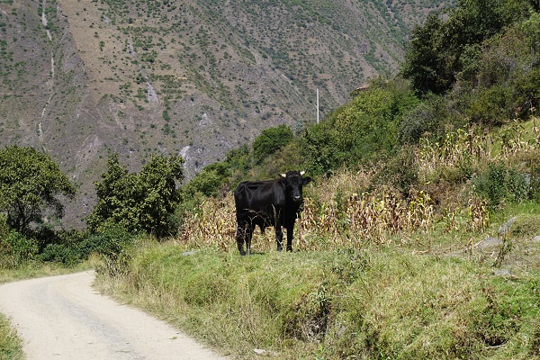
You will pass a cute house with doors on the second floor. The road slowly winds down the mountain and passed several bulls like this:
When this road meets the main road, Camino a Willoq, turn right to and follow it all the way back to town. If you were coming by road you can’t miss the big sign here. The picture is looking back at it from Camino a Willoq.
Most of the road is dusty gravel and there were very few cars. You may want to try and get out of the way, if possible, when cars do come to avoid a mouthful of dust. It is a little boring but an easy walk. We felt looking up at the terraces was more impressive than looking down. You will pass a sleepy village and several homes on the way back to town. This sign made us giggle.
That’s it! Reward yourself with a nice meal!
Our Experience
We had some GPS points and maps downloaded to my phone and wasn’t too hard to follow the trails once we found the trail heads, but getting those right was tricky at some points. We had one point where it was clear that a lady was telling us we were going the wrong way but we could not understand a word of what she was saying. Not sure if she was speaking Quichuan or if it was just the lack of teeth. We only saw two other groups during the entire half-day hike and most of the homes we passed were empty, probably because of the festival.
The hike took us around fields, by homes, close to bulls, up a mountain, under a flock of parakeets, past waterfalls, across ancient terraces, over streams, and through a fence. We passed farms that were in the midst of harvesting in the old fashion way (you can’t use tractors and combines on terraces). Most of the trail ran alongside a manmade stream, diverting the water to homes and crops. This wasn’t an elegant aqueduct, a pipe or a plastic channel. All of it was dug into the ground, lined with stone in some places and very occasionally a bit of concrete.
When we finally could see the ruins at the end of the trail we were confronted with a fence. We were trying to figure out which way to go when a lady flagged us down and pointed for us to go through it and hurried over to collect out entrance fee. The ruins were interesting but not particularly impressive compared to the pyramid in town, but did sit on a mountainside with a commanding view of the surrounding areas and we were the only ones there.
As we started our decent, we saw the girls at the bottom trying to figure out which way we would come down and collect their merchandise so they could intersect us. When we got down there was a very young girl at the foot of the trail with her trinkets laid out. We were morally conflicted as to whether supporting this was a good or bad idea, but did buy something from her.
On our way back to town we passed at least a dozen bulls close to the side of the road. Most of them were tied up with a small cord but that wasn’t exactly confidence inspiring. Most of the road was long and boring by comparison to the hike, it did give us a different perspective looking up at the areas we had passed instead of down. Tall eucalyptus tree swayed in the wind overhead and perfumed much of our walk.
See the article on Ollantaytambo for more information on the town, things to do, and how to get there.
More?
Check out our full Peru Trip Itinerary.
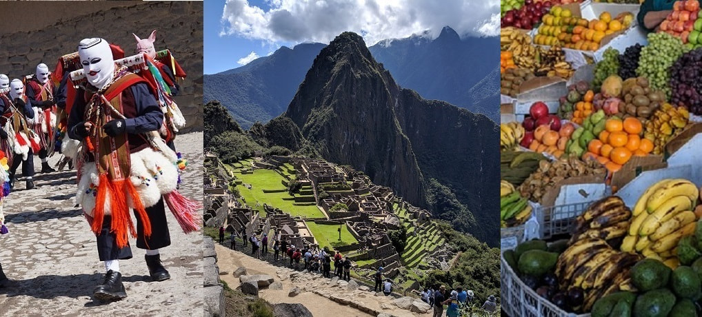
Explore the city and food of Historic Cusco
Everyone goes to Machu Picchu but getting there can be just as epic. We had an amazing experience on the Salkantay Trek
There are also many more spectacular hikes in and around Ollantaytambo