Last year we made a giant loop of some of Canada’s best National Parks and got a brief taste of each. We loved it so much that we did it again this year, for the same week, with a slightly different itinerary. This time we went further north, spending the majority of our time in Jasper National Park, with plenty of stops on the way there and back. We have spent two weeks in the Canadian Rockies now and we still feel like we have just barely scratched the surface!
We traveled with our pup, so many of our activities were dog friendly and he had a blast too.
The most congestion we saw was the road work construction around big bend, which created a large traffic backup.
All viewpoints have details and photos embedded in the map. View the map full screen for easier viewing.
Itinerary
Day 1 - To Kamloops
- Afternoon - Drove to Kaploops
- Evening - Explored the Riverwalk in Kamloops
- Stayed at a hotel in Kamloops
Day 2 - Yellowhead Highway Drive to Mount Robson Provincial Park & Jasper National Park
- Drove one the scenic Yellowhead Highway
- Stopped at Reaguard Falls, Rearguard Provincial Park
- Visited the Mount Robson Visitor Center
- Hiked the Overlander Falls Trail, Mount Robson Provincial Park
- Hiked Maligne Canyon, Jasper
- Stayed in Hinton
Day 3 - Jasper National Park
- Visited Medicine Lake, Jasper
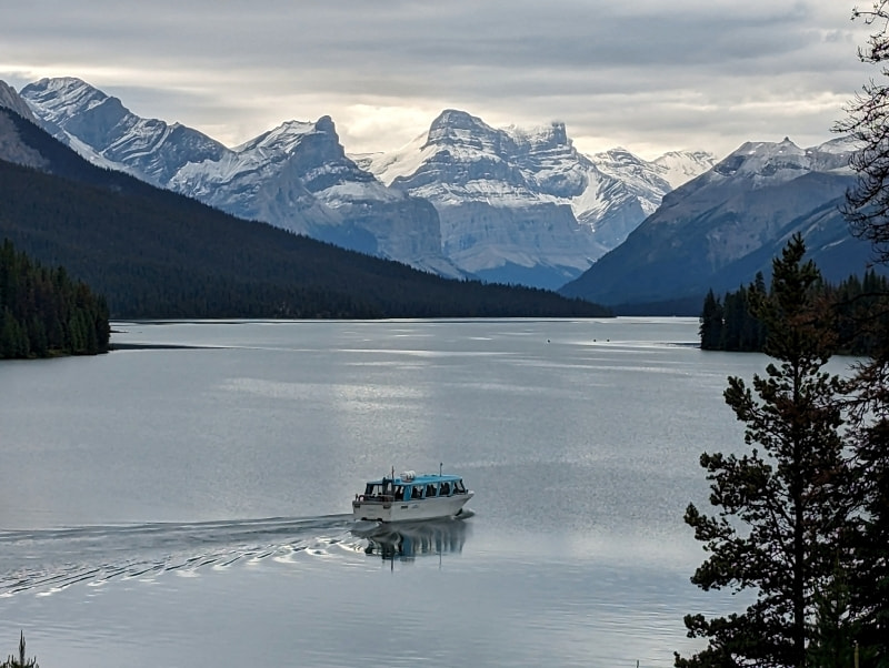
- Visited Maligne Lake, Jasper
- Hiked Moose Lake Loop @ Maligne Lake, Jasper
- Hiked Bald Hills @ Maligne Lake, Jasper (favorite in Jasper)
- Stayed in Hinton
Day 4 - Jasper National Park
- Visited Pyramid Lake, Jasper
- Kayaked Patricia Lake, Jasper
- Hiked the Patricia Lake North Loop (Hochimini) Trail, Jasper
- Stayed in Hinton
Day 5 - Jasper National Park
- Hiked Path of the Glacier @ Edith Cavell, Jasper
- Hiked Edith Cavell Meadows Loop to East Ridge Summit, Jasper
- Explored Jasper Town
- Hiked the Athabasca River Flower Loop, Jasper
- Stayed in Hinton
Day 6 - Jasper National Park
- Drove the Icefield Parkway from Jasper to The Crossings
- Many stops for sightseeing
- Visited the Jasper Icefield Visitor Center
- Hiked the Toe of the Glacier Trail, Jasper
- Hiked Wilcox Trail, Jasper
- Stayed in Cline River
Day 7 - Kootaney Plains, Banff National Park, Yoho National Park
- Hiked the Kootaney Plains Heritage Trail Loop Trail
- Hiked to Cirque Lake, Banff
- Visited the Yoho Visitor Center
- Stopped at Faeder Lake, Yoho
- Stayed in Donald
Day 8 - Glacier National Park & Drive Home
- Hiked the Hermit Trail, Glacier
- Traveled home
Resources - Useful links and trip planning tools
Driving Experiences - Including Bears
Kamloops
We were driving up from Seattle after work and Kamloops made a good stop over location. The city is cute and has an extensive waterfront park with all kinds of activities, including sports courts and playgrounds. Only some of this park is dog friendly but the section on the map above was and had an off-leash beach area. To the west of the beach there was a nice walkway with art exhibits. You can see a clip of the dog beach in the video above.
Find this park and more Kamloops attractions here.
Rearguard Falls Provincial Park
- Dog friendly
- Not too busy (mid-day on a holiday weekend)
- Semi-accessible - gravel path with large hill
- Viewpiont Trail: 0.6 km (.4 miles), 28 m (90 ft) elevation gain
A great quick stop to stretch your legs. The viewing platform gets you incredibly close to the rushing water! It is crazy to think that fish come all this way to spawn and that a few even go a little further. If you jump to the 2:15 mark in the video above you can see a little of the falls.
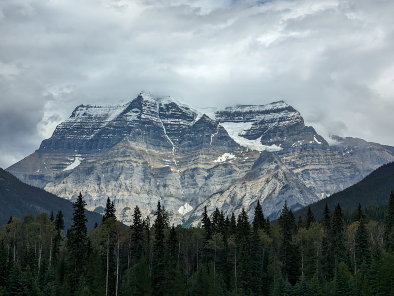
Mount Robson Provincial Park
- Dog friendly (mostly)
- Not too busy (mid-day on a holiday weekend)
- Visitor center with great exhibits (accessible)
- Overlander Falls Trail: 1-5 km (.6-3 miles miles), 50-140 m (180-470 ft) elevation gain
- Yellowhead Lake scenic stop and picnic area
I really wish we had more time here and definitely need to go back. We had aspirations of doing one of the lake trails or Robson Meadows Lookout Trail, but it was a drizzly day with a chance of afternoon thunderstorms so we settled for the falls trail. We did luck out with a great view of the park’s namesake from the visitor center deck when the clouds parted briefly. The visitor center had a 3D topo map, a couple exhibits, an information desk staffed by rangers, a gift shop, and great bathroom.
If you skip to 2:30 in the video above you can see a little of this park.
Hinton
Not the ideal place to stay but if you book too late, like we did, or have a restricted budget there are some reasonable accommodations here and food prices are a bit more reasonable too. The town has a couple of grocery stores to pick from and a bunch of restaurants. A few places, like Freson Bros., offer free overnight RV parking, restrooms, and other services. There is a large dump in town that sometimes makes the place a bit smelly.
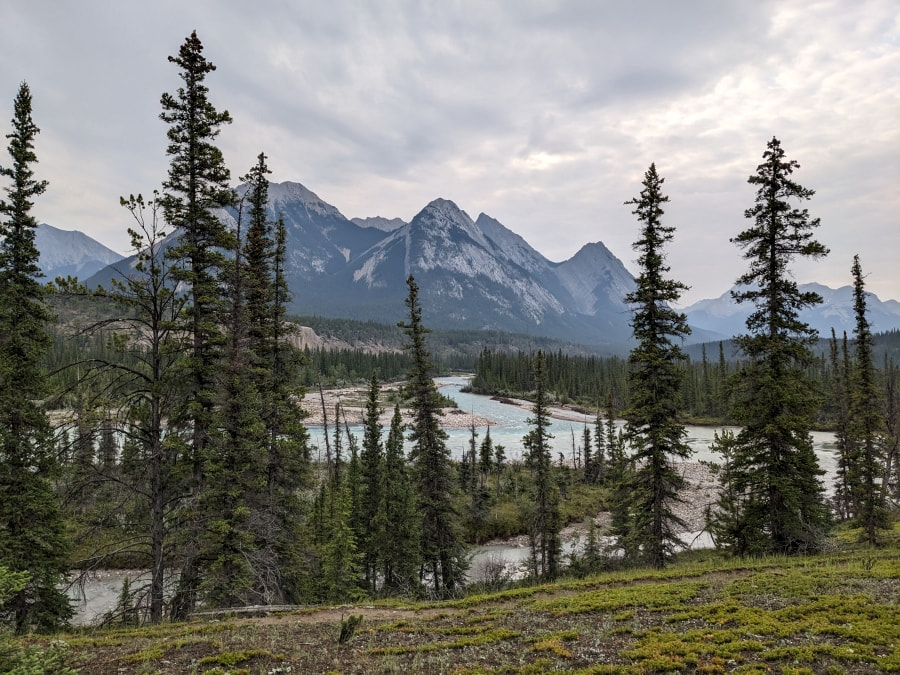
Driving back and forth to Jasper makes each day a bit longer but the Yellowhead Highway is stunning, especially at golden hour, and I would recommend doing this drive once regardless. One day we were greeted by bighorn sheep at the gate. Hinton is also well situated for visiting the Sulphur Skyline Trail and hot springs, but sadly the road washed out just a couple weeks before our visits.
If you skip to 3:45 in the video above you can see a bit of this drive.
Jasper National Park
-
Dog friendly (mostly)
-
Mostly not too busy
-
Jasper Town Area - Possible drizzly day activities
- Maligne Canyon Loop: 4.6 km (2.9 miles), 110 m (370 ft) elevation gain, more below
- Kayaked around Patricia Lake - Flat water paddle, inflatable friendly
- Hiked Patricia Lake North Loop (Hochimini) Trail: 3.7 km (2.3 miles), 85 m (280 ft) elevation gain, map - Easy quiet trail
- Hiked the Athabasca River Flower Loop: 2.4 km (1.5 miles), 10 m (40 ft) elevation gain, map - Easy quiet trail
-
Maligne Lake
- Hiked Moose Lake Loop: 2.7 km (1.7 miles), 100 m (350 ft) elevation gain, map - Easy
- Hiked Bald Hills: 14.6 km (9.1 miles), 700 m (2300 ft) elevation gain, more below - no dogs
-
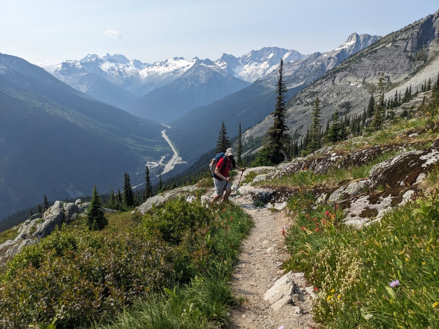
Edith Cavell - More below
- Hiked Path of the Glacier: 2.6 km (1.6 miles), 120 m (390 ft) - Easy trail that gets busy
- Hiked Edith Cavell Meadows Loop & East Ridge Summit: 10 km (6.2 miles), 835 m (2740 ft) - no dogs
-
Icefield Parkway
- See the map at the top of this page for stops with photos and info
- See the map at the top of this page for stops with photos and info
-
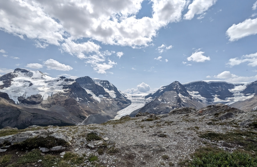
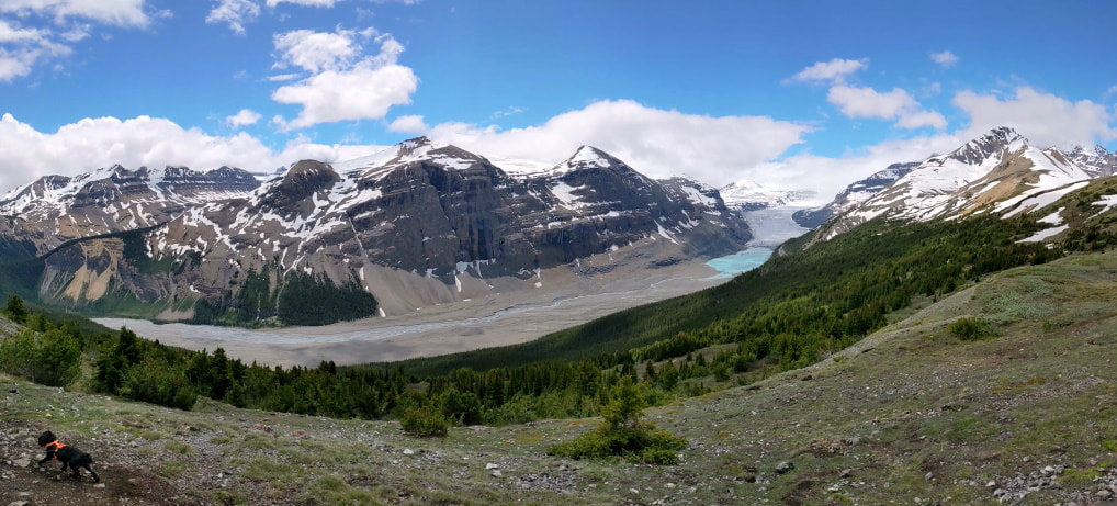
Athabasca Glacier & Columbia Icefield
- Hiked Wilcox Trail: 9.8 km (6.1 miles), 440 m (1440 ft) elevation gain, more below
- Hiked Toe of the Glacier: 1.7 km (1.1 miles), 45 m (150 ft) elevation gain, map - Easy trail but crowded and parking fills up
Maligne Canyon Loop: -Map- This place gets packed and parking can be difficult. The trail was nice, but not worth the crowds for us. I felt that Mistaya Canyon on the Icefield Parkway and Marble Canyon in Kootaney National Park were just as good, with much fewer people. We did have a nice break from the conga line on the way back. Instead of taking the normal loop we opted for the narrow track that crosses just above the falls trail and it felt like our own private route. It is only a hair higher but it is high enough for a couple of mountain views and a different perspective.
Recommended Gear: Waterproof shoes (his/hers) will make the mud and water crossing much more comfortable and you should bring your basic hiking kit.
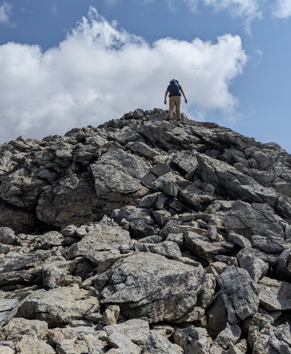
Bald Hills: -Map- Our favorite hike of the trip! The linked map has some photos from along the hike. No crazy terrain on this one but poles are helpful. There are a lot of different options and variations so you can choose your own adventure. The views of the mountains and delicate alpine vegetation were really nice and as you go up it feels like the lake just keeps growing. You are just under 8000 feet/2450 meters, so you might feel this one a little bit more than usual.
Recommended Gear: Hiking poles, sun protection, and bear spray would be a good addition here to your basic hiking kit.
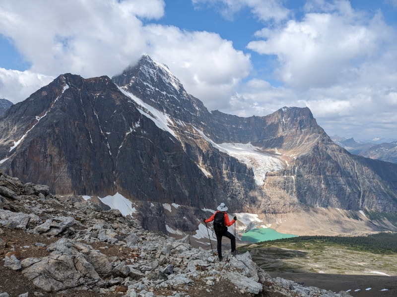
Edith Cavell & East Ridge Summit: -Map- This was another favorite. This area does get busy, so we got up and got to the parking lot around 8:30AM on July 4th and we were one of just a handful of vehicles. We walked down the Path of the Glacier Trail to the iceberg pool and we were one of the only ones there for a bit. We saw it from above in the afternoon and it was mobbed so I would recommend going early and doing that first.
There is very little shade anywhere in this area so bring plenty of water and sun protection. Also note that you are at relatively high altitude so hiking may feel harder than normal and it is important to stay hydrated.
The meadow loop was just bursting with flowers and it was stunning! I would recommend poles because some of the terrain coming down is a touch rough. When you leave the main loop and start heading up to the “end of trail” the terrain turns from flowers to narrow bare scree track and the view didn’t change much, so unless you are going for the peak I would recommend staying in the meadow.
Above the “end” the trail stays well defined but gets progressively rougher until you hit the final climb which is basically straight up a rock stack. The terrain is a mix of scree and loose rock so be careful and know you limits. Views up there were stunning in every direction and we had a very friendly marmot try to join us for lunch.
Recommended Gear: Hiking poles, solid shoes (his/hers), sun protection, and bear spray are highly recommended in addition here to your basic hiking kit.
Wilcox Trail: -Map- This trail gets busy and parking often fills up. We enjoyed it but if we had to choose we would pick Parker Ridge instead, because we thought it had better views. Wilcox has spectacular views of the Columbia Icefield but we just didn’t feel they were all that different than what you see from the visitor center. You are up a little higher so you can see the buses up on the glacier and there is a fun photo opp with some red chairs.
Recommended Gear: Sun protection and bear spray are recommended in addition here to your basic hiking kit.
Kootenay Plains
- Dog friendly (mostly)
- Not too busy
- Heritage Trail: 3.7 km/2.3 miles, 60 meters/190 feet elevation gain/loss - East side is a quiet easy trail
Kootenay Plains is just off the Icefield Parkway but is much less visited and many people have never even heard of it. This place doesn’t have the same wow factor but it has tons of beautiful camping options, more hikes, and an off the grid feel. Don’t expect to have cell phone service out here and even if you stay at a hotel the internet may be spotty.
Heritage Trail: Trailhead Location: 52.051803, -116.41080 | Pretty trail along a river on the east side and an interesting grave site at the north end. I recommend taking this east trail as an out and back instead of making a loop. The west side of the trail was hard to follow and extremely overgrown. We went after a rain shower and we were completely soaked to the skin from all the plants dumping water on us. The east side is a mild up and down along the riverside with some mountain views.
Recommended Gear: Sun protection and bear spray are recommended in addition here to your basic hiking kit.
Banff National Park
- Dog friendly
- Icefield Parkway
- Cirque Lake: 9.8 km/6.1 miles, 250 meters/820 feet elevation gain/loss - Quiet, moderate trail
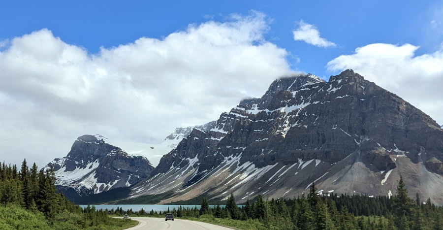
Banff is world renown, so with that comes a different level of crowds and a different kind of tourist. We learned from last year’s trip that the Icefield Parkway seems to be the relatively quiet part of the park, with the exception of a few of the popular stops. We drove the Icefield Parkway again and only did one hike this time, but we had it all to ourselves! See Icefield Parkway and Banff for more Banff adventures.
Cirque Lake: -Map- This trail was a muddy mess, but we had it mostly to ourselves and it really felt like a real hidden gem. We visited mid-morning on a Thursday on a holiday week for both Canadians and Americans. The color of the water and glaciers on the mountains surrounding it were stunning.
Canadian Glacier National Park
- Dog friendly (mostly)
- Not too busy
- Hermit Trail: 5.8-7.0 km / 3.6-4.4 miles round trip, 810 meters / 2660 ft elevation gain - Strenuous trail
This park was stunning to drive through and hike in! I really wish we had more time here and definitely need to go back. The dive was framed by beautiful mountains with waterfalls everywhere. If you skip to 1:50 in the video above you can see a snippet of the drive. See Glacier for the previous year’s Canadian Glacier adventure.
Hermit Trail: -Map-: This one may not be considered a hidden gem (although I would argue Canada’s Glacier National Park is very underrated) but it was remarkably quiet for how accessible it was! We didn’t see anyone until we we over halfway up and there was just one camper at the top and it was a Friday on a holiday week for the Canada and the United States. This one is a leg burner and will get your heart rate up.
Recommended Gear: Hiking poles, solid shoes (his/hers), sun protection, and bear spray are highly recommended in addition here to your basic hiking kit.
Resources
Day Trip Basics - Good to have on any hike
Weather:
Mountain Weather - Great for specific areas, just make sure you select the right elevation.
Trail Conditions:
Reqarguard Falls Provincial Park
Glacier National Park of Canada
Passes & Reservations:
Which pass to buy - This work for all the nationalparks, not just Banff.
Park Reservations - Includes shuttles and camping.
Product Links: I am not sponsored by any of the products I link to. If you choose to make a purchase from one of the links of a product I listed or any other item a small percentage will go back to me to fund this website, at no additional cost to you. The products I link to are either ones I have used or similar if those are not available. Thank you for your support.
More?
For the best day of this amazing trip check out our experience on the Icefield Parkway
Iceland Trip Itinerary & Travel Budget.
Check out our full Peru Trip Itinerary.